
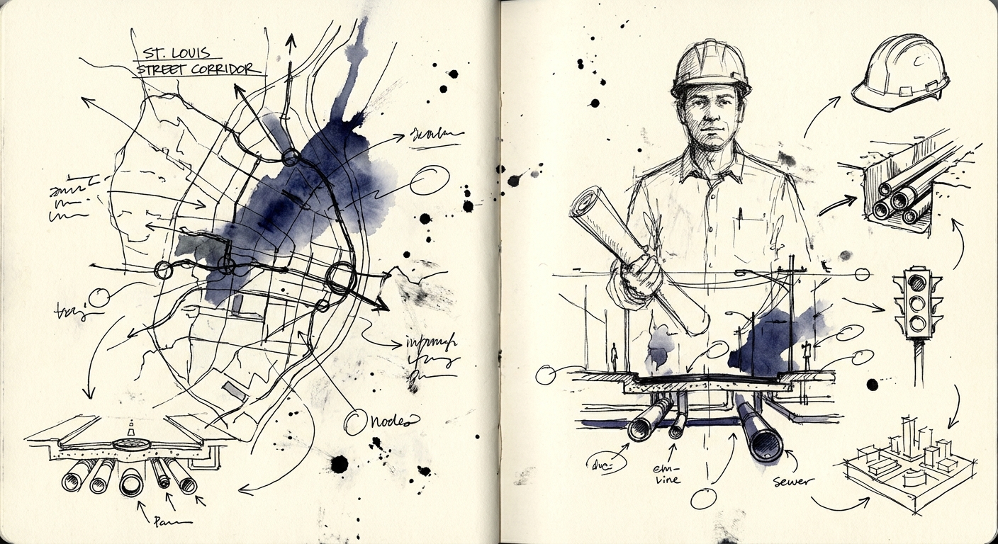
Urban Infrastructure Revitalization: An Analysis of the St. Louis Street Corridor and National Investment Models
Why do cities repeatedly tear up the same roads? We explore the complex reasons behind urban infrastructure projects, using Mobile, Alabama's St. Louis Street as a case study.
Listen to this article
16 min listen
Urban Infrastructure Revitalization: An Analysis of the St. Louis Street Corridor and National Investment Models
The cyclical nature of urban roadwork frequently presents a paradox to the public and civic observers alike: a municipality will seemingly complete major construction or streetscaping on a commercial corridor, only to return a decade later to tear up the exact same asphalt. This phenomenon naturally prompts questions regarding the efficacy, planning, and financial stewardship of municipal infrastructure investments. In the case of St. Louis Street in downtown Mobile, Alabama, the progression from the revitalization efforts of the early 2010s to the current multimillion-dollar "Complete Streets" infrastructure overhaul provides a textbook case study in the evolution of urban planning and civic engineering.
The public perception that an earlier road project was "done wrong" or represents a waste of taxpayer funds often stems from a fundamental misunderstanding of the difference between surface-level streetscaping (or localized private building rehabilitation) and deep-subsurface infrastructure reconstruction. To fully understand the current realities of St. Louis Street, one must examine the architectural history of the corridor, the mechanics of pavement degradation, the strategic financial mechanisms currently utilized by the City of Mobile, and the broader national shift toward integrated, multi-modal infrastructure models, such as "Dig Once" policies.
The Evolution of St. Louis Street: From Automobile Alley to Technology Corridor
To contextualize the current investments and evaluate the work performed in the past, it is necessary to trace the historical and architectural evolution of the St. Louis Street corridor. Nicknamed "Automobile Alley," the street was developed in the early 1920s during a pivotal transition in American urban mobility—the shift from pedestrian and streetcar transit to the personal automobile. Unlike adjacent downtown streets that featured small commercial footprints designed for pedestrian shoppers, St. Louis Street was engineered with exceptionally wide lanes and on-street parking specifically designed to accommodate sprawling car dealerships, service stations, and automotive parts warehouses.
By the mid-twentieth century, as suburbanization drew populations, retail centers, and eventually the automotive dealerships themselves westward away from the city center, the downtown core was largely abandoned. The dealerships left behind highly durable but vacant masonry and concrete structures. For decades, the corridor suffered from blight and disuse, acting as a dormant commercial artery.
The First Wave of Revitalization (2010–2017)
The construction and revitalization work observed by the public 10 to 15 years ago was largely the result of private real estate development, supplemented by minor civic aesthetic upgrades, rather than a comprehensive municipal infrastructure overhaul. Catalyzed by the creation of the Alabama historic tax credit program in 2013, private developers began to recognize the adaptive reuse potential of the corridor's robust buildings. The architectural remnants of the automotive era—characterized by open floor plans, heavy load-bearing floors, and large clerestory windows—proved highly attractive to modern technology, engineering, and creative firms.
During this era, pioneering developers purchased abandoned properties and restored them to federal preservation standards. A major turning point occurred in 2012 when the vacant 1926 Buick Building was acquired and restored, subsequently attracting the technology company Rural Sourcing and serving as a catalyst for the street's rebirth. These private investments triggered a wave of redevelopment, transforming the former automotive dealerships into a burgeoning technology and entertainment hub. Notable redevelopments included the Innovation PortAL (housed in a former Volkswagen dealership), Precision Engineering (occupying the 1926 Kittrell-Milling Motor Company building), and various local breweries and commercial offices.
The municipal work accompanying this private economic boom was largely reactive, aesthetic, and surface-level. As new businesses opened, civic organizations such as the Downtown Mobile Alliance and the newly formed Business Improvement District (BID) executed localized streetscape improvements. These initiatives included the patching of sidewalks, the installation of pedestrian-friendly lighting, urban beautification through flower plantings, and standard asphalt repaving. While these improvements temporarily enhanced the visual appeal and basic walkability of the street, they did not address the century-old utilities deteriorating beneath the pavement.
Deconstructing the "Done Wrong" Perception: The Mechanics of Pavement Failure
The assumption that the initial civic work was executed incorrectly conflates surface maintenance with structural rehabilitation. In the lifecycle of urban infrastructure, municipalities constantly balance limited capital budgets against immediate maintenance needs. When a city simply repaves a road using the common "mill and fill" technique, construction crews use milling machines to remove only the top layer of distressed asphalt and replace it with a fresh wearing course. This approach is highly cost-effective and rapidly improves ride quality for motorists.
However, mill and fill paving is entirely ineffective as a long-term solution if the underlying subgrade, base layer, or subsurface utility network is failing. Potholes, expansive alligator cracking, and pavement warping are rarely spontaneous surface failures; they are almost universally symptoms of subsurface instability. When water infiltrates surface cracks, it deteriorates the road base. Furthermore, if century-old water mains, sanitary sewer lines, or drainage culverts beneath the road begin to leak or collapse, the resulting subterranean voids cause the pavement above to sink, fracture, and fail repeatedly regardless of how many times the surface is repaved.
The current St. Louis Street project requires total, disruptive excavation precisely because the underlying infrastructure dates back to the Gilded Age. During the current excavation process, engineering crews exposed a massive brick-walled box culvert dating back to 1905, constructed during former Mayor Lyon's administration. A 1905 brick culvert cannot safely support the load-bearing requirements of a modern commercial corridor, nor can 1920s-era water and sewer lines support the increased hydraulic density of new multi-story mixed-use developments, restaurants, and tech offices.
Therefore, the work executed 10 to 15 years ago was not "done wrong"; it was merely a temporary, surface-level accommodation designed to rapidly support early private investment and improve basic aesthetics. The current project represents the necessary, albeit highly disruptive, full-depth reclamation and utility modernization required to sustain the corridor's economic output for the next century.
| Development Phase | Primary Timeframe | Primary Actors | Scope of Work | Infrastructure Depth |
|---|---|---|---|---|
| Phase I: Adaptive Reuse | 2012–2017 | Private Developers (aided by Historic Tax Credits) | Building renovations, facade restoration, adaptive reuse of automotive showrooms into tech offices and retail. | Above-ground, localized private utility hookups into legacy mains. |
| Phase I: Surface Maintenance | 2012–2017 | Municipal Public Works & Business Improvement Districts | Mill and fill asphalt patching, localized sidewalk repairs, aesthetic streetscaping, pedestrian lighting. | Surface level (top 2-4 inches of pavement) and superficial right-of-way. |
| Phase II: Complete Streets | 2022–2028 | City of Mobile, ALDOT, Federal Agencies, Utility Partners | Full roadway reconstruction, ADA compliance, total utility undergrounding, massive stormwater overhaul. | Full-depth (subgrade replacement, subterranean utilities, 1905 culvert replacement). |
The Current Initiative: The St. Louis "Complete Streets" Project
The current initiative on St. Louis Street is a $16.7 million, 17-block total infrastructure overhaul extending from Broad Street to Water Street. Awarded to the local firm McElhenney Construction Company, the project reached its midpoint in the summer of 2026 and is slated for final completion in the first quarter of 2028. The expansive scope of this endeavor reflects a modern urban planning philosophy known as "Complete Streets," which mandates that transportation corridors be designed, engineered, and operated to enable safe access for all users, including pedestrians, bicyclists, motorists, and transit riders, rather than prioritizing vehicular throughput alone.
Subsurface Modernization and Stormwater Management
The true foundation of the current project lies deep beneath the asphalt. The City of Mobile, operating through a strategic cooperative agreement with the Mobile Area Water and Sewer System (MAWSS), is executing a total replacement of legacy water lines, inserta valves, and wastewater systems to meet the demands of high-density commercial tenants.
Most critically, the project addresses the corridor's antiquated stormwater drainage infrastructure. Coastal cities like Mobile face severe hydrological challenges driven by intense seasonal rainfall and Gulf Coast storm surges. The existing 1905 brick culvert was grossly inadequate for modern runoff volumes and posed a structural risk to the roadway above. Construction crews are currently pouring a highly secure, modern concrete lid over the historic box culvert to stabilize the roadway foundation and drastically improve stormwater runoff management. The sheer complexity of these subterranean upgrades dictated a sequential, block-by-block construction framework to minimize disruption to active businesses. The first four blocks of the corridor required approximately six months of intensive excavation solely to resolve these deep stormwater deficiencies.
Utility Undergrounding and Spatial Reallocation
A hallmark of high-tier downtown revitalization is the removal of overhead visual clutter, which simultaneously improves civic resilience and aesthetics. In close coordination with an extensive network of utility partners—including Alabama Power, Spire Gas, Uniti Fiber, Comcast, AT&T, Lumen, and CSpire—the city is moving all overhead powerlines and telecommunications infrastructure underground.
This comprehensive undergrounding achieves two primary objectives. First, it protects critical utilities from the severe weather events and hurricanes prevalent on the Gulf Coast, thereby preventing catastrophic power and data losses during crises. Second, the removal of cumbersome utility poles reclaims significant spatial real estate on the sidewalks. This recovered space allows for widened, ADA-compliant pedestrian pathways and the implementation of a comprehensive urban forestry plan. The project's landscaping design introduces 77 trees (incorporating a "right tree, right place" methodology to prevent future root interference with the newly laid utilities), alongside 1,335 shrubs and perennials, and 1,380 groundcover plants.
Traffic Optimization and Pedestrian Friction
The engineering of the roadway itself is undergoing a fundamental paradigm shift away from legacy mid-century designs. Historically, downtown streets across America were converted to one-way, multi-lane thoroughfares specifically designed to expedite the evacuation of workers to the suburbs at the close of the business day. However, urban planners now universally recognize that high-speed, one-way streets are inherently hostile to retail environments, commercial real estate development, and pedestrian safety.
Driven by the Downtown Street Optimization Project—a comprehensive master plan developed by walkability expert Jeff Speck and Nelson\Nygaard for the Downtown Mobile Alliance—the city is actively reversing twentieth-century traffic engineering. Over 20 intersections throughout the downtown grid, including five specific intersections on St. Louis Street, are being converted from traditional traffic signals to four-way stops. Furthermore, several adjacent downtown streets (including St. Joseph, Warren, Dearborn, and Bayou streets) are being converted from one-way arteries to yield-flow, two-way streets that allow on-street parking.
The removal of traffic signals and the introduction of two-way traffic generates intentional "pedestrian friction." Traffic signals inherently incentivize drivers to accelerate rapidly to "beat the light," creating deadly environments for pedestrians. Conversely, four-way stops require motorists to drastically reduce speed, make eye contact with pedestrians, and negotiate the right-of-way. This calming effect not only reduces collision severity but forces drivers to process their peripheral environment at a human scale, leading to increased visibility and foot traffic for local businesses.
| Design Element | Traditional 20th Century Infrastructure | Modern "Complete Streets" Optimization | Impact on Corridor Revitalization |
|---|---|---|---|
| Traffic Flow | Multi-lane, one-way streets prioritizing rapid vehicular evacuation to suburbs. | Yield-flow, two-way streets prioritizing local access and navigation. | Eliminates "circling the block," improves property access, and reduces traffic speeds. |
| Intersection Control | Synchronized traffic signals incentivizing high-speed driving between lights. | Four-way stops at low-volume intersections. | Creates pedestrian friction, forces eye contact, and drastically improves pedestrian safety. |
| Sidewalk Spatial Use | Cluttered with overhead utility poles, limited ADA clearance. | Utilities buried underground, widened pathways. | Allows for expansive urban forestry (e.g., 77 trees on St. Louis St.) and outdoor commercial seating. |
| Subsurface Utilities | Reactive patching of century-old clay pipes and brick culverts. | Full-depth replacement with modern concrete, PVC, and high-capacity fiber optics. | Supports high-density residential and commercial real estate development without risk of infrastructure failure. |
Implications for Mobile's Infrastructure Investment Strategy
The massive scale and ambition of the St. Louis Street project serves as a microcosm for the City of Mobile's broader evolution in fiscal and infrastructural management. Historically, municipalities operating under tight fiscal constraints relied almost entirely on reactive maintenance—patching potholes, placing steel plates over failing trenches, and repairing broken pipes only after a catastrophic failure occurred. Mobile's ability to transition from a reactive posture to a proactive, comprehensive planning model is directly attributable to the establishment of highly reliable local capital funding mechanisms.
The Capital Improvement Plan and the Penny Sales Tax
The fundamental turning point for Mobile's infrastructure occurred in 2015 with the passage of the "penny sales tax" under the administration of Mayor Sandy Stimpson. Prior to this localized tax initiative, the city lacked the discretionary capital required to execute major, multi-year civil works, relying instead on piecemeal federal grants or emergency borrowing. The penny sales tax established a dedicated, robust revenue stream that currently funds the city's Capital Improvement Plan (CIP).
The CIP operates on a rolling five-year schedule, meticulously identifying critical capital asset projects across categories such as transportation, parks and greenways, environmental protection, and public safety. The CIP currently injects approximately $32 million annually into local infrastructure. Since its inception, the program has generated over $200 million in localized tax revenues for road resurfacing, sidewalk construction, and facility upgrades across all city council districts.
Crucially, the reliable local revenue generated by the CIP allows the City of Mobile to provide the requisite "matching funds" necessary to unlock massive federal and state grants. Infrastructure projects of this magnitude are never funded by a single entity; they require a highly complex financial mosaic. The city's improved financial stewardship, which has led to a strong AA bond rating, allows it to confidently engage in these multi-agency funding structures.
| Funding Source | Origin / Agency | Purpose within the St. Louis Street Project |
|---|---|---|
| RESTORE Act | Federal (Dept. of the Treasury) / Gulf Coast Ecosystem Restoration Council | Primary funding ($10.7M) directed at ecosystem sustainability, stormwater runoff improvement, and regional economic revitalization following the 2012 Deepwater Horizon settlement. |
| ALDOT & MPO | State (Alabama Dept. of Transportation) / Regional (Mobile Metropolitan Planning Organization) | Transportation Alternatives Program (TAP) funding ($2.6M) specifically allocated for roadbed reconstruction, ADA compliance, and pedestrian enhancements. |
| MAWSS | Local (Mobile Area Water and Sewer System) | Direct funding ($4.2M) via a cooperative agreement for the total overhaul of legacy water lines and sanitary sewer systems beneath the street. |
| City of Mobile Match | Local (CIP / Penny Sales Tax / General Fund) | Matching funds ($665,000) and ongoing programmatic support, which serve as the mandatory leverage enabling the acquisition of the larger federal and state grants. |
Reversing the Damage of Urban Renewal
The strategic investments guided by the CIP represent a broader, highly intentional attempt by the city to rectify the mid-century urban planning errors that severed historic communities. Concurrent with the St. Louis Street project, Mobile is executing massive "Complete Streets" overhauls on Broad Street and Dr. Martin Luther King Jr. Avenue.
During the Urban Renewal era of the 1960s and 1970s, many historic minority neighborhoods across the United States were demolished or bisected by aggressive highway and arterial road expansions. In Mobile, Broad Street was expanded into a hostile, high-speed, seven-lane expanse that acted as a physical and economic barrier, isolating neighborhoods from the downtown core. The current multimillion-dollar projects on these corridors (including a $30+ million investment on Broad Street and an $11.2 million investment on MLK Jr. Avenue) aim to completely reconstruct the roadways.
These projects incorporate buffered bicycle lanes, strategically placed on-street parking, advanced pedestrian safety crosswalks, and direct connections to the Three Mile Creek Greenway Trail. This indicates that Mobile's infrastructure strategy has matured far beyond mere utility repair or surface beautification; the city is actively utilizing public works to achieve socioeconomic equity, neighborhood reunification, and historical restorative justice.
National Trends: The Inefficiency of Siloed Infrastructure
The frustration expressed by citizens regarding the cyclical tearing up of roads is not unique to Mobile; it is a pervasive, systemic issue deeply embedded in the operational structures of municipalities across the United States. The root cause of this national inefficiency is the traditional "siloed" organizational structure of municipal governments and private utility monopolies.
Historically, municipal departments operate entirely independently, constrained by strict budgets, competing timelines, and distinct departmental mandates. The Department of Transportation (DOT) is tasked with paving roads to maintain vehicular safety; the local water authority is tasked with replacing leaking pipes; and private telecommunications companies are tasked with laying fiber-optic cables to expand broadband access. Because these entities rarely coordinate their capital deployment schedules, a newly paved road may be immediately excavated by a telecommunications company laying fiber, and then excavated again months later by a gas company repairing a main.
Every time a continuous sheet of asphalt is cut, the structural integrity of the pavement is permanently compromised. Even when a rectangular utility trench is properly backfilled and patched with top-tier materials, the seam between the old asphalt and the new patch creates a vulnerability. The localized compaction of the subgrade in a narrow trench is rarely as dense as the original roadbed, leading to differential settling. This allows water infiltration during freeze-thaw cycles or heavy rains, inevitably leading to premature pavement failure and the rapid formation of new potholes. This lack of coordination wastes millions in taxpayer funds, shortens the lifespan of capital assets, and causes severe, prolonged disruption to local businesses and commuters.
The "Dig Once" Policy Revolution
To combat this systemic inefficiency, modern urban planners, civil engineers, and lawmakers are increasingly adopting "Dig Once" or "Joint Trenching" policies. A Dig Once policy mandates that whenever a public right-of-way is excavated for a major infrastructure project (such as a road rebuild, sewer replacement, or sidewalk expansion), the municipality or the primary excavator must simultaneously install multi-path conduit—inexpensive plastic piping that can house future telecommunications and broadband infrastructure.
The economic rationale for Dig Once policies is overwhelming. According to industry analyses, the physical excavation of roads and the subsequent repair of the asphalt accounts for 75% to 90% of the total cost of deploying underground fiber-optic networks. By installing excess conduit while the road is already open, future Internet Service Providers (ISPs) can simply thread their fiber-optic cables through the existing pipes without ever breaking the pavement, drastically accelerating broadband deployment while preserving the road surface.
The implementation of Dig Once policies operates on several core principles:
- Mandatory Notification: Excavators applying for permits in the public right-of-way must notify all utility and telecommunications partners of the impending open trench, inviting them to lay their infrastructure concurrently.
- Shadow Conduit Installation: The local government funds the installation of empty "shadow" conduit during public works projects. The municipality retains ownership of this conduit and can lease the space to private broadband providers, generating a long-term revenue stream while lowering the barrier to entry for competing ISPs.
- Long-Term Capital Alignment: Aligning the multi-year capital improvement plans of the DOT, the water authority, and private utilities to ensure that subsurface repairs occur simultaneously with surface paving.
Federal and State Legislative Momentum
The recognition of Dig Once as a vital policy tool has reached the highest levels of government. The U.S. Federal Highway Administration (FHWA), acting under Section 607 of the MOBILE NOW Act, has promulgated rules requiring state Departments of Transportation to designate broadband utility coordinators and establish electronic notification processes to align highway construction with broadband deployment.
At the state level, at least 16 states (including Arizona, California, Colorado, Georgia, Illinois, Iowa, Maine, Maryland, Massachusetts, Minnesota, Nevada, New Mexico, North Carolina, Texas, Utah, and West Virginia) have implemented formal Dig Once policies. These policies range from voluntary coordination registries to strict statutory mandates requiring the inclusion of broadband conduit in all publicly funded highway projects. As unprecedented federal funding flows to municipalities through the Bipartisan Infrastructure Law (BIL) and the American Rescue Plan Act (ARPA), local governments are being heavily incentivized to adopt Dig Once frameworks to maximize the return on taxpayer investment.
The St. Louis Street project is a highly successful localized manifestation of this philosophy. By proactively coordinating with MAWSS, Alabama Power, and six different telecommunications providers to install all necessary utilities simultaneously before the final concrete and asphalt are poured, the City of Mobile is attempting to ensure that the corridor's surface will remain undisturbed for decades.
Models for Upgrading Downtown Revitalization Corridors
The transformation of St. Louis Street provides a highly replicable, comprehensive model for other American cities seeking to revitalize decaying downtown commercial corridors. The era of executing standalone paving projects is ending. Successful corridor redevelopment relies on a sophisticated synthesis of aesthetic design, traffic engineering, utility modernization, and blended finance.
1. The Integrated Corridor Management (ICM) Model
Modern revitalization abandons the fragmented approach of repairing individual assets (e.g., fixing a single pothole or upgrading a single crosswalk) in favor of Integrated Corridor Management (ICM). The ICM model views the corridor as a holistic system, integrating freeway access, arterial traffic, transit systems, pedestrian mobility, and subsurface utilities into a single, unified master plan. By managing the corridor as an interconnected ecosystem, cities can deploy technological and engineering strategies that improve overall efficiency and economic output rather than merely shifting traffic bottlenecks from one intersection to the next.
2. Pedestrian-Centric "Complete Streets"
Revitalization models recognize that economic vitality in a downtown corridor is directly proportional to foot traffic. The "Complete Streets" model shifts the hierarchy of road design away from the rapid throughput of vehicular traffic toward pedestrian safety and multi-modal transit. This involves narrowing vehicular lanes to naturally force drivers to reduce their speed (a concept known as a "road diet"), installing dedicated cycle lanes that are physically separated from vehicular traffic, and ensuring all crosswalks and transit stops exceed the compliance standards of the Americans with Disabilities Act.
3. De-Coupling One-Way Networks
As demonstrated by the Downtown Mobile Alliance's optimization plan, successful revitalization often requires the political will to dismantle the one-way street networks imposed during the mid-twentieth century. One-way streets act as high-speed funnels that limit navigational flexibility, induce unnecessary vehicle miles traveled (as drivers are forced to circle blocks), and reduce the visibility of retail storefronts. Converting these corridors to two-way, yield-flow traffic reduces vehicle speeds, improves property access, and dramatically increases the street's attractiveness to commercial real estate developers and retail tenants.
4. Layered Financing and Public-Private Synergy
Perhaps the most crucial model for successful corridor revitalization is the orchestration of blended financing. Municipal general funds are rarely sufficient to cover the tens of millions of dollars required for full-depth infrastructure projects. Successful cities leverage localized mechanisms—such as Tax Increment Financing (TIF) districts or Business Improvement Districts (BIDs)—to capture the future tax revenues generated by the improved corridor.
These local funds are then strategically used as the mandatory match to secure massive federal and state grants related to environmental restoration (e.g., the RESTORE Act), transportation alternatives (e.g., ALDOT TAP), and economic development. Crucially, this public investment must be synchronized with private investment. The public sector's commitment to permanently rebuilding the streetscape acts as a risk-mitigation signal to private developers. When developers see a municipality installing century-grade utilities and high-quality streetscaping, they can confidently utilize Historic Tax Credits and private capital to rehabilitate the adjacent architecture, resulting in a compounding cycle of urban revitalization.
Conclusion
The extensive construction currently underway on Mobile's St. Louis Street is not indicative of past municipal failure, but rather highlights the fundamental difference between surface-level aesthetic maintenance and structural, full-depth infrastructure reclamation. The private development boom of the early 2010s simply outpaced the capacity of the corridor's Gilded Age subsurface utilities. The current $16.7 million investment is a necessary, generational correction designed to permanently stabilize the roadway, overhaul the 1905 stormwater systems, and underground modern telecommunications to support a burgeoning technology and entertainment district.
This project perfectly encapsulates the national shift in municipal management. Cities are rapidly moving away from reactive, siloed departmental repairs that result in the endless, wasteful cyclical excavation of roads. Instead, through the adoption of "Dig Once" policies, Complete Streets engineering methodologies, and integrated Capital Improvement Plans financed by localized mechanisms like the penny sales tax, municipalities are striving to build highly resilient infrastructure.
For cities across the country looking to revitalize their urban cores, the underlying lesson is clear: surface beautification cannot sustain long-term economic growth if the foundational infrastructure is crumbling. True revitalization requires the political will to endure the disruption of deep excavation, the financial acumen to blend diverse funding streams, and the engineering foresight to build infrastructure that seamlessly accommodates pedestrians, environmental realities, and the digital economy of the future.
Works cited
1. $16M St. Louis Street project halfway to 2028 finish | Mobile Bay Now, https://mobilebaynow.com/16m-st-louis-street-project-halfway-to-2028-finish/ 2. City Of Mobile Approves $17M Contract To Overhaul St. Louis Street, https://www.cityofmobile.gov/city-updates/city-of-mobile-approves-17m-contract-to-overhaul-st-louis-street/ 3. The Resurgence of Automobile Alley - Mobile Bay Magazine, https://mobilebaymag.com/the-resurgence-of-automobile-alley/ 4. Stephen McNair with McNair Historic Preservation - Mobile Alabama's, https://www.mobileal.com/podcast/stephen-mcnair-mcnair-historic-preservation 5. The Buick Building - EquityPlus, LLC, https://www.equityplusllc.com/portfolio-item/the-buick-building/ 6. Mike Rogers and his team at Rogers & Willard are helping to rewrite Mobile's story - Business Alabama Magazine, https://businessalabama.com/mike-rogers-and-his-team-at-rogers-willard-are-helping-to-rewrite-mobiles-story/ 7. Turner-Todd Motor Company - Wikipedia, https://en.wikipedia.org/wiki/Turner-Todd\_Motor\_Company 8. 2025-2030 Mobile, Alabama, https://www.downtownmobile.org/uploads/pdf/DigitalUploadofCompleteManagementPlan.pdf 9. 2014–2015 - Downtown Mobile Alliance, https://www.downtownmobile.org/uploads/pdf/2014-15AnnualReportFinal.pdf 10. 7 Signs When Repaving a Road Becomes Necessary for Safety & Longevity, https://redstone-cg.com/blog/when-repaving-a-road-becomes-necessary/ 11. Why Do Pot Holes Keep Coming Back? | Government - Asphalt Zipper, https://asphaltzipper.com/blog/why-do-pot-holes-keep-coming-back/ 12. ELI5: Why they tear up random rectangular strips of the highway just to fill them back in again with lesser materials. - Reddit, https://www.reddit.com/r/explainlikeimfive/comments/deshlc/eli5\_why\_they\_tear\_up\_random\_rectangular\_strips/ 13. St Louis Street - Map for Mobile, https://mapformobile.org/stlouisstreet/ 14. St. Louis Street Reconstruction Project Breaks Ground Today : r/MobileAL - Reddit, https://www.reddit.com/r/MobileAL/comments/1nl7avk/st\_louis\_street\_reconstruction\_project\_breaks/ 15. 361 St Louis Street, Mobile, AL 36602 | Crexi.com, https://www.crexi.com/properties/2599007/alabama-361-st-louis-street 16. Benefits of converting downtown Mobile's streets from one-way to two-way flow include, https://www.downtownmobile.org/uploads/pdf/two\_way\_brochure.pdf 17. Alabama Dauphin Street - Mobile - AARoads, https://www.aaroads.com/guides/dauphin-st-mobile-al 18. Three Downtown Mobile Streets Converting To Two-way Traffic On Jan. 22, https://www.cityofmobile.gov/city-updates/three-downtown-mobile-streets-converting-to-two-way-traffic-on-jan-22/ 19. Downtown Street Optimization : City of Mobile, Alabama, https://www.cityofmobile.gov/downtown-street-optimization/ 20. An integrated approach for municipal infrastructure interventions management - Concordia's Spectrum, https://spectrum.library.concordia.ca/980182/1/Meite\_MSC\_F2015.pdf 21. CAPITAL IMPROVEMENT PLAN 2023-2027 - Map for Mobile, https://mapformobile.org/wp/wp-content/uploads/2023/02/CIP-23-27\_Final\_forPrint\_Optimized.pdf 22. Untitled - City of Mobile, https://www.cityofmobile.gov/pdf/CityOfMobile-16Pager-for-web.pdf 23. Mayor Sandy Stimpson has moved Mobile forward during his decade in office - Business Alabama Magazine, https://businessalabama.com/mayor-sandy-stimpson-has-moved-mobile-forward-during-his-decade-in-office/ 24. CAPITAL IMPROVEMENT PLAN 2022-2026 - Map for Mobile, https://mapformobile.org/wp/wp-content/uploads/2022/02/CIP\_2022-2026FINAL-220117-web.pdf 25. FISCAL YEAR PROPOSED ANNUAL BUDGET - City of Mobile, https://www.cityofmobile.gov/uploads/file\_library/com-fy2025-proposed-budget-document-(2).pdf 26. Annexation : City of Mobile, Alabama, https://www.cityofmobile.gov/annexation/ 27. Redeveloping Broad Street (and MLK Jr. Avenue) - Map for Mobile, https://mapformobile.org/broad-street/ 28. Mobile breaks ground on $11M 'Complete Streets' project for Dr. Martin Luther King Jr. Avenue | The Bama Buzz, https://thebamabuzz.com/mobile-breaks-ground-on-11m-complete-streets-project-for-dr-martin-luther-king-jr-avenue/ 29. Mobile's Civil Rights & Cultural Heritage District, https://www.mobilecountyal.gov/uploads/TheDistrictMasterPlan-FINAL2.28.25.pdf 30. City of Mobile Set to Begin $17 Million Resurfacing Project on 250 Streets from 2026 CIP, Highest Resurfacing Program Mobile has Undertaken - Reddit, https://www.reddit.com/r/MobileAL/comments/1t4k66c/city\_of\_mobile\_set\_to\_begin\_17\_million/ 31. Building Resilient Communities: The Power of Dig Once Policies - National League of Cities, https://www.nlc.org/article/2023/05/18/building-resilient-communities-the-power-of-dig-once-policies/ 32. sustainable infrastructure initiative: - interdepartmental planning for better capital projects - Seattle.gov, https://www.seattle.gov/documents/Departments/OPCD/Vault/SustainableInfrastructure/SustainableInfrastructureInitiativeReport.pdf 33. DIG ONCE POLICY: 16 STATE MODELS, https://cdn.ymaws.com/fiberopticsensing.org/resource/resmgr/page-policy/policy/fosa-state-dig-once-policies.pdf 34. Dig Once: How Federal, State, and Local Governments Can Reduce the Cost of Broadband Deployment, https://cdn.vanderbilt.edu/vu-URL/wp-content/uploads/sites/412/2025/12/12003228/Dig-Once.pdf 35. Dig Once Policy - City of South San Francisco, https://www.ssfca.gov/Departments/Public-Works/Divisions/Engineering-Division/Dig-Once-Policy 36. A Technical Guide to Dig Once Policies - - ctc technology & energy, https://www.ctcnet.us/insights/a-technical-guide-to-dig-once-policies/ 37. Broadband Infrastructure Deployment - Federal Register, https://www.federalregister.gov/documents/2021/12/03/2021-26231/broadband-infrastructure-deployment 38. National Operations Center of Excellence Integrated Corridor Management Peer Exchange Tuesday, August 23, 2022 - NOCoE, https://transportationops.org/system/files/uploaded\_files/2023-05/NOCoE%20ICM%20Peer%20Exchange%20Summary.pdf 39. Triangle Region ITS Strategic Deployment Plan Update (2020), https://www.twtpo.org/sites/default/files/uploads/what-we-do/Funding%20Programs%20and%20Databases/ITS/its-main\_report\_06-2020-1.pdf 40. Mobile City Council Approves Contract to Remove Traffic Lights and Most 1-Way Streets in Downtown Mobile - Reddit, https://www.reddit.com/r/MobileAL/comments/1lk9f0t/mobile\_city\_council\_approves\_contract\_to\_remove/