
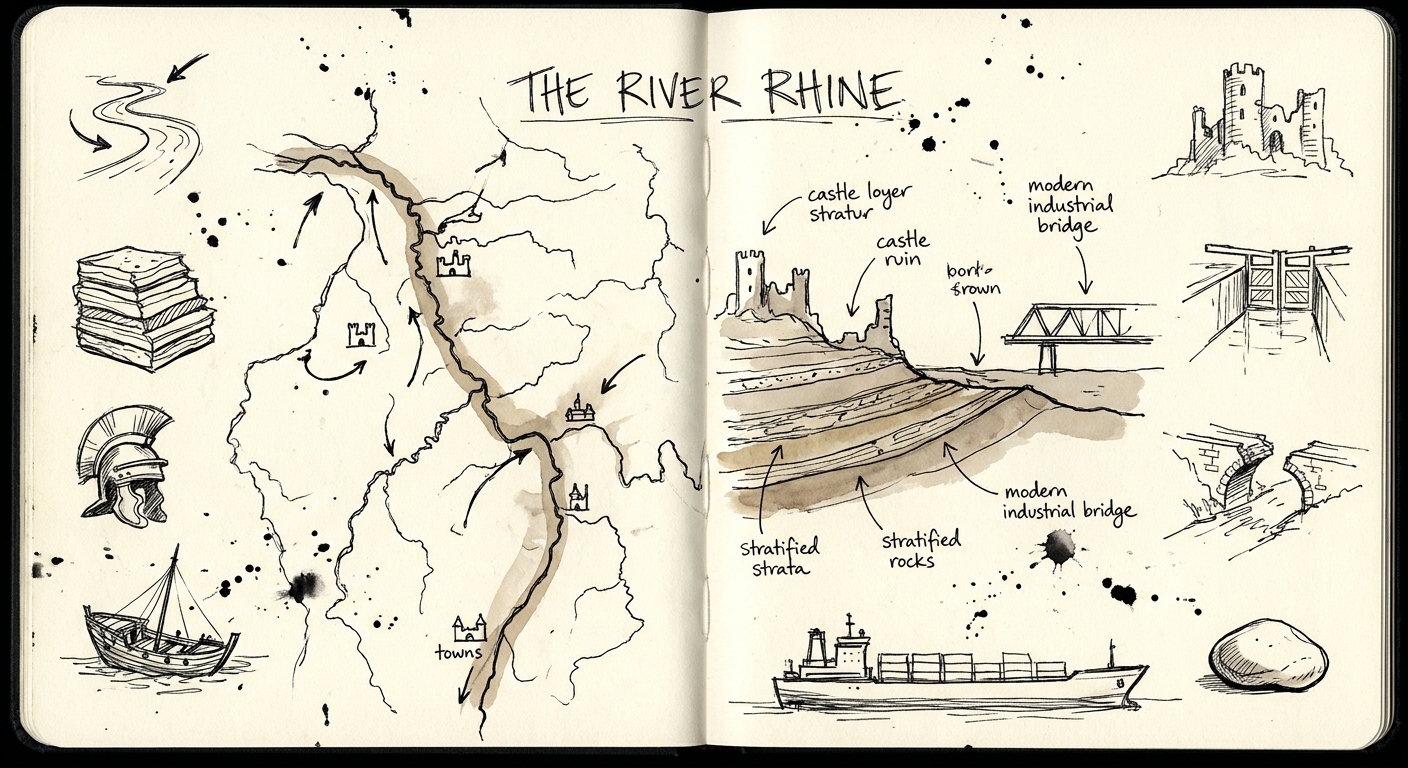
The River Rhine: A Comprehensive Geological, Cultural, and Geopolitical History
From ancient tectonics to modern energy, discover how Europe's most vital waterway has shaped human civilization for millennia.
Listen to this article
57 min listen
The River Rhine: A Comprehensive Geological, Cultural, and Geopolitical History
The River Rhine constitutes one of the most vital, dynamic, and historically significant fluvial systems on the European continent. Flowing from its headwaters in the Swiss Alps to its expansive delta in the North Sea, the river has functioned alternately as a formidable political boundary and a unifying cultural and economic artery. Its historical trajectory is inextricably linked to its geological morphology, which dictated the patterns of prehistoric human settlement, facilitated the unparalleled expansion of the Roman Empire, served as the central geographical and political axis for the Holy Roman Empire, and ultimately fueled the industrialization that shaped modern Europe. This report provides an exhaustive, multi-disciplinary analysis of the Rhine, tracing its evolution from deep geological time through its profound influence on prehistoric societies, the Roman epoch, the spread of Christianity, the complex geopolitics of the Middle Ages, the devastation of the World Wars, and its contemporary role in global supply chains and environmental management.
1. Geological History and Fluvial Morphodynamics
The prominence of the River Rhine and its extensive network of tributaries is a direct consequence of highly complex tectonic activities, climatic fluctuations, and massive glaciations that occurred over millions of years. The river drains an immense catchment area exceeding 185,000 square kilometers, with its geological foundations deeply tied to the tectonic evolution of the European continent.
The Alpine orogeny, resulting from the prolonged convergence of the European and African tectonic plates during the Tertiary period, created the structural foundation of the Rhine's upper reaches. The outer portions of the western Alps consist of intensely folded late Palaeozoic and Mesozoic sediments, while the interior is characterized by dense crystalline rocks derived from the Aare and Gotthard Massif intrusions. As the Alps rose, massive amounts of erosional debris were deposited into the adjacent molasse basin—comprising shallow marine and fluvial environments of Tertiary age—which significantly influenced the topography of the region and dictated early water flow.
The river's course is fundamentally tied to the European Cenozoic Rift System, meaning the sedimentary deposits of the Rhine preserve an extensive and highly detailed record of tectonic activity, climate shifts, and sea-level changes. The Rhine is geographically and geologically subdivided into several distinct zones, each reflecting specific tectonic or glacial origins:
| Geological Subdivision | Geographic Extent | Key Geological and Morphological Characteristics |
|---|---|---|
| Vorderrhein & Hinterrhein | Swiss Alps (Headwaters in Graubünden) | Inner-alpine rivers guided by tectonic lines; valley floors are frequently blocked by mass movement deposits, creating distinct flow patterns. |
| Alpenrhein & Bodensee | Main Alpine Valley to Lake Constance | Drains into a large foreland basin; characterized by moraine ridges and outwash plains that directly reflect the Quaternary glaciations of the Alps. |
| Hochrhein (High Rhine) | Lake Constance to Basel | Flows westward following the Jura Mountains; features glacial outwash geomorphology and dramatic elevation drops, notably the Rhine Falls. |
| Oberrhein (Upper Rhine) | Basel to Mainz | A massive graben structure forming part of the middle Tertiary rifting system; includes the Mainz Basin, characterized by the remains of initial marine transgressions. |
| Mittelrhein (Middle Rhine) | Bingen to Bonn (Rhenish Massif) | Defined by tectonic uplift well-documented by a flight of late Tertiary to Quaternary river terraces; features young volcanic activity in the adjacent Eifel volcanic field. |
| Niederheinische Bucht | Lower Rhine Embayment to the Delta | Sedimentary basin heavily influenced by sea-level changes; site of historical river avulsions shaping the modern delta topography. |
In the lower reaches and the delta region, fluvial discharge supply has historically been the most critical boundary condition for estuary evolution. The Rhine has never maintained a static course; its delta is a highly dynamic geological environment. For instance, around 7,300 calibrated years before present (cal. yr bp), a distinct Rhine distributary began to flow into the tidal basin. By 6,500 cal. yr bp, a major avulsion event 40 kilometers inland formed the Old Rhine River distributary. Both the mouth and the tail of the Rhine, including the Haringvliet, have shifted locations repeatedly over millennia due to a combination of natural hydrodynamics, sediment loading, and, in later epochs, extensive anthropogenic interventions. These shifting fluvial dynamics created a rich, fertile, and highly varied landscape that would eventually attract some of Europe's earliest human populations.
2. Prehistoric Settlement and Cultural Genesis
The ecological richness, fertile floodplains, and navigability of the Rhine Valley made it a primary corridor for early European settlement. During prehistoric times, the same cultural groups existed on both banks of the river, indicating that the Rhine acted as a unifying environment and a conduit for technological transmission rather than a divisive border.
The Neolithic and Bronze Age Expansion
During the Neolithic period, the Linear Pottery culture (LBK), flourishing from approximately 5500 to 4500 BCE, left substantial archaeological evidence along the upper and middle Rhine regions. These populations introduced agriculture, domesticated livestock, and characteristic linear-banded ceramics, establishing the first permanent agrarian settlements in the loess-rich soils of the valley. The region was not without conflict; mass graves found in southern Germany indicate instances of organized violence among competing LBK tribes. As the Middle Neolithic progressed, population densities in the Rhine area experienced significant fluctuations. Evidence suggests a pronounced drop in settlement density and the abandonment of figurative traditions before a robust reoccupation occurred after 4800 BCE, coinciding with the rise of the Stroked Pottery culture.
Throughout the transition from the Late Neolithic to the Early Bronze Age, populations such as the Bell Beaker groups utilized the Rhine-Meuse area extensively. They oriented their settlements toward river valleys, crevasse splays, and river dunes, relying on a highly sophisticated hunting-farming mixed economy that highlighted both cultural continuity and adaptation to the dynamic fluvial landscape. The strategic placement of these settlements allowed prehistoric peoples to leverage the river's abundant aquatic resources while avoiding the catastrophic seasonal inundations typical of the Rhine's unpredictable hydrology.
Bronze Age excavations, particularly in regions connecting the Rhine and Danube river systems (such as the Western Allgäu), reveal that prehistoric populations recognized the immense economic value of these waterways for long-distance trade. Despite harsh climates and gravelly soils, the population density was remarkably high—potentially featuring a settlement every five kilometers around 3500 BCE—driven by the economic advantages of controlling the nexus between the Alpine passes, the Rhine, and the Danube. This era also saw the sophisticated use of logboats to navigate the river networks. Archaeological discoveries of Bronze Age logboats—carved from single oak or field maple tree trunks using bronze axes—demonstrate an early mastery of riverine navigation. Some of these vessels measured over 20 feet in length and were utilized to lay fish traps and transport vital cargo. Furthermore, regions like the Federsee bog, located near the Main European Watershed separating the Rhine and Danube systems, strongly indicate that portages were utilized to transport goods and vessels across land between the two massive river systems, integrating land and water routes into a pan-European prehistoric economy.
The Iron Age: Hallstatt and La Tène Cultures
By the Late Bronze Age and Early Iron Age (1200–450 BCE), the Hallstatt culture predominated in the Rhine region. Associated with Proto-Celtic speaking populations, the Hallstatt culture was characterized by advanced metallurgical capabilities, significant social stratification with emerging elite chieftain and warrior classes, and the establishment of extensive long-range trade networks. The Rhine served as a primary conduit for the famed Amber Road, an ancient trade route facilitating the transfer of amber ("the gold of the north") from the North and Baltic Seas southward to the Mediterranean, Italy, and Greece. Raw and worked amber flowed upstream along the Rhine alongside salt, tin, and other commodities, establishing an intricate web of prehistoric European economic integration that linked northern tribes with Mediterranean civilizations.
The Hallstatt culture was seamlessly succeeded by the La Tène culture (c. 450–1 BCE), widely considered the apex of Celtic civilization. Originating in the "Celtic cradle" around the middle Rhine area and northeastern France, the La Tène people exhibited highly organized societal structures and produced intricate, sophisticated art. They transitioned from open settlements to highly planned, fortified hill towns known as oppida. These oppida featured standardized building designs and massive defensive walls constructed of a complex matrix of timber and stone, known as Murus Gallicus. The La Tène warriors were also highly innovative, developing chain mail armor using a "4-to-1" interlocking iron ring pattern, a technology later adopted by the Romans as the lorica hamata. A complex network of roads connected these major oppida along the Rhine, many of which would later evolve into foundational Roman cities.
## 3. The Roman Frontier: Hegemony, Engineering, and Immigration
The written human history of the Rhine begins abruptly with the aggressive expansion of the Roman Republic. For much of Roman history, the Rhine was far more than a simple geographical feature; it was a rigid political boundary, a massive military highway, a vital economic artery, and a profound cultural fault line separating the classical Mediterranean world from the Germanic tribal societies of northern Europe.
Establishing the Limes Germanicus
The Roman interaction with the Rhine was inaugurated by Julius Caesar, who famously bridged and crossed the river in 55 and 53 BCE. These expeditions yielded little permanent military conquest; rather, they served as a demonstration of unparalleled Roman engineering prowess to the Senate and acted as a psychological terror tactic against the Germanic tribes. Caesar officially declared the Rhine to be the definitive boundary between the Gallic (Celtic) nations to the west and the Germanic tribes to the east, formalizing a geopolitical division that would persist for centuries.
Following Caesar, Marcus Vipsanius Agrippa initiated aggressive resettlements, moving the Ubian tribe to what would become Cologne (Colonia Claudia Ara Agrippinensium) and the Batavians to the Rhine delta, using them as reliable buffer states and auxiliary forces. The Roman general Drusus launched major campaigns across the river, conquering the Lippe area and initiating massive hydrological engineering projects, such as the moles Drusiana (a dam to redirect water) and the Fossa Drusiana (a canal connecting the Rhine to Lake Flevo). However, the consolidation of the Rhine frontier changed drastically following the catastrophic defeat of the Roman commander Quinctilius Varus in the Teutoburg Forest in 9 CE. This disaster forced Rome to permanently abandon its ambitions of conquering the territories east of the river.
The frontier was subsequently formalized as a permanent defensive structure under Emperors Caligula and Claudius, and later expanded by Domitian, who built a large palisade through the Taunus mountains. This frontier defense system became known as the Limes Germanicus. Crucially, modern archaeological, sedimentological, and palynological evaluations reveal that the Limes on the Lower Rhine was not an impermeable, static wall. Instead, it functioned as a "wet Limes"—an open, dynamic corridor serving as a march area, a vital trade route, and a highly active supply line.
Fluvial Engineering and Urbanization
Roman military strategy along the Rhine required highly specialized engineering adapted to a dynamic riverine environment. The troops were primarily supplied by ship, necessitating direct and permanent access to the waterway. When planning forts, military camps, and emerging civilian towns, Roman engineers deliberately positioned these settlements on the raised edges of the Lower Terraces, closely adjacent to the steep undercut banks of river meanders. This positioning was highly strategic: steep undercut banks allowed the Romans to construct permanent quays, ensuring that heavy transport ships could moor year-round, even during periods of low water.
To protect their critical infrastructure from the river's powerful currents and its natural tendency to shift course, the Romans implemented sophisticated bank protection structures known as Packwerk. This engineering effectively stabilized the river's meanders, anchoring the wet Limes physically in place. The massive military presence along the river created an unprecedented economic ecosystem. By the second century, the Rhine supported more than 40,000 soldiers organized into four major legions:
| Roman Legion | Stationed Location | Strategic Function |
|---|---|---|
| XXX Ulpia Victrix | Xanten (Colonia Ulpia Traiana / CUT) | Guarded the Lower Rhine; featured major Packwerk stabilized quays and ship ramps. |
| I Minervia | Bonn (Bonna) | Secured the transitional zone between the Lower and Middle Rhine. |
| XXII Primigenia | Mainz (Mogontiacum) | Commanded the strategic confluence of the Rhine and the Main river. |
| VIII Augusta | Strasbourg (Argentoratum) | Guarded the Upper Rhine; constructed vital military roads to the Danube. |
The immense logistical demand for food to support these troops acted as a significant economic incentive. Massive quantities of grain were imported from the Meuse and Moselle areas to feed the legions. This continuous economic activity transformed riverside military camps into booming urban centers. Cities such as Cologne, Bonn, Mainz, and Strasbourg flourished through the trade of metal, silver, amber, horses, and enslaved people, physically and economically linking the Rhineland to the Mediterranean via the Moselle, Saône, and Rhône rivers.
Immigration, Cultural Exchange, and Late Antiquity Decline
The Roman borders were characterized by gradual transitions rather than hard, impenetrable lines, deeply influencing immigration, cultural assimilation, and economic exchange. The Limes facilitated the movement of goods and people between the military, the integrated civilian populations, and the broader Germanic hinterland. The Rhine became a melting pot where indigenous Celtic and Germanic traditions merged with Roman administrative, architectural, and linguistic practices.
However, the stability of the Limes began to dissolve in Late Antiquity (from the end of the 3rd century CE onward). In 260 CE, the Agri decumates (the occupied east bank of the Middle Rhine) were lost to the Alamanni. As the Western Roman Empire experienced severe internal political fragmentation, civic alienation, and continuous military crises, the meticulous maintenance of the highly complex Packwerk bank protections ceased.
Without continuous human engineering to restrain it, the Rhine rapidly regained its natural morphodynamics. Former main channels and active meanders that had hosted bustling Roman quays began to silt up or aggressively shift course. Environmental evidence shows that between 400 and 600 CE, the river migrated nearly 2.8 kilometers downstream at sites like Wesel. This environmental dissolution physically mirrored the political collapse of the Roman frontier. The Roman era on the Rhine effectively concluded in 406 CE when various Germanic tribes crossed the frozen river en masse, piercing the frontier and accelerating the disintegration of the Western Roman Empire.
4. The Spread of Christianity and the Carolingian Axis
The post-Roman period, often characterized as the "Dark Ages" due to political anarchy, warfare, and massive demographic shifts during the Migration Period, witnessed the slow but deliberate spread of Christianity. The Rhine River served as the primary conduit for this profound cultural transformation, connecting the remnants of Roman administrative centers with the pagan Germanic tribes settling in the region.
Monastic Missions and Mass Conversions
Between 500 and 1000 CE, the conversion of Europe was driven by two concurrent forces: the papacy in Rome attempting to centralize religious authority, and independent monastic missionaries arriving from Ireland and England. The Rhine valley was the central theater for these evangelistic efforts. The spread of the faith was fundamentally tied to the political consolidation of the Merovingian and, later, the Carolingian dynasties. Conversion in this era was rarely an individualistic pursuit; it was inextricably tied to tribal leadership. When a leader, such as the Frankish King Clovis around 500 CE, converted to Catholic Christianity, his entire retinue and associated tribes followed suit, setting a precedent for mass conversions across the region.
The network of Catholic kingdoms that arose on the ruins of the Roman Empire was unified by Church law, utilizing the Rhine as a highway for synods, ecclesiastical trade, and the transit of relics. Early missionaries targeted the Frisians in the lower Rhine, with figures like Willibrord initiating extensive conversion efforts around 690 CE.
However, the most pivotal figure in the Christianization of the Germanic lands was Saint Boniface (born Winfrid), an Anglo-Saxon monk. In 723 CE, Pope Gregory II appointed Boniface as the bishop for all of Germany east of the Rhine. Boniface established a robust network of highly influential bishoprics and monastic centers along the river system. He utilized both spiritual pedagogy and striking physical actions—such as the legendary felling of a sacred pagan oak tree—to assert the dominance of the new religion over indigenous beliefs. Boniface founded the famous Abbey of Fulda in 743 CE and served as the archbishop of Mainz, turning the city into a paramount ecclesiastical powerhouse. The spread of Christianity along the Rhine resulted in the establishment of enduring, powerful episcopal seats at Trier, Cologne, Mainz, Speyer, and Worms, which would dominate the political landscape for centuries.
Dorestad: The Carolingian "Dutch Troy"
As Christianity unified the cultural landscape, the economic void left by the Roman collapse was eventually filled by the rise of the Frankish kingdom and the Carolingian Empire, which decisively re-centered European power along the Rhine. The pinnacle of early medieval trade on the river—and the economic engine of Charlemagne's world—was the massive trading emporium of Dorestad.
Situated in the delta region at the strategic fork of the Rhine and the Lek, near modern Wijk bij Duurstede, Dorestad flourished from the late 7th to the mid-9th century. It functioned as the largest shipping hub in northwestern Europe, linking the wealthy German Rhineland with Scandinavia, the Baltic Sea, northern France, and England. Often referred to by modern historians and archaeologists as the "Dutch Troy" due to its near-mythical status and tragic end, Dorestad was a marvel of early medieval urban planning. Excavations initiated by J.H. Holwerda in 1922 revealed that the emporium stretched for an astounding three kilometers along the banks of the Kromme Rijn. It featured massive timber wharves and distinct districts for harbor activities (the "Lower town"), a trading center, and an agricultural hinterland.
However, Dorestad's immense prosperity made it a prime target. During the 9th century, it was repeatedly sacked by Viking raiders seeking to plunder its wealth. Furthermore, the settlement suffered a fatal geographic and hydrological blow: the riverbed began to shift. The lower Rhine was eventually dammed near Wijk bij Duurstede in the 12th century, causing the river mouth at Katwijk to silt up completely, destroying the natural navigational routes. The combination of devastating maritime raids and shifting fluvial dynamics erased Dorestad from prominence, vividly illustrating the precariousness of riverine dependency in the early Middle Ages.
5. The Holy Roman Empire: Fragmentation, Trade, and Sovereignty
Following the division of the Carolingian Empire through the Treaty of Verdun in 843 CE, the Rhine temporarily served as the eastern boundary of Lotharingia. However, by 870 CE, the river once again became the central geographical and geopolitical axis of a new political unit: the Holy Roman Empire. Over the next millennium, the Rhine valley witnessed profound political decentralization, serving as the primary stage for struggles over trade, tolls, and imperial authority.
The Golden Bull of 1356
The fragmented, decentralized nature of the Holy Roman Empire was formally codified by the Golden Bull of 1356, an imperial edict issued by Emperor Charles IV at the Diets of Nuremberg and Metz. Designed to prevent the chronic succession crises and devastating civil wars that plagued the empire, and to explicitly limit papal interference in imperial affairs, the Golden Bull established a permanent, unalterable council of seven Prince-Electors responsible for choosing the King of the Romans (the future Emperor).
Tellingly, the geographic and political center of gravity of this new constitutional order lay squarely on the Rhine. Three of the seven electors were the immensely powerful Rhenish Archbishops of Mainz, Trier, and Cologne, while a fourth was the Count Palatine of the Rhine. The edict recognized the multilingual nature of the empire, mandating that the heirs of the electors be instructed in German, Latin, Italian, and Slavic languages to facilitate imperial diplomacy.
More importantly for the regional economy, the Golden Bull granted these electors near-sovereign rights within their territories. They were given the power to mint their own coinage, exercise exclusive judicial authority (with no right of appeal to the Emperor), and—most critically—the right to collect river tolls. This legalization of territorial sovereignty severely weakened the central authority of the Emperor, permanently entrenching particularism and turning the Rhine into a heavily fragmented patchwork of competing micro-states.
The Toll Economy and the "Robber Barons"
The geography of the Middle Rhine Valley, where the river carves a narrow, steep, and winding gorge between Bingen and Koblenz, made it exceptionally easy to control shipping traffic. Because the river was the primary artery for transporting bulk goods (such as timber, wine, ores, and salt) across Europe, controlling a stretch of the Rhine guaranteed immense wealth.
While the Archbishops and high nobility had explicit imperial permission to levy tolls, the chronic breakdown of central authority—particularly during the Great Interregnum (1250–1273)—led to the rapid proliferation of Raubritter (Robber Knights or Robber Barons). These rogue aristocrats built heavily fortified castles atop the steep slate cliffs of the gorge, strung heavy iron chains across the water to halt passing ships, and extorted exorbitant, unauthorized tolls from merchant vessels. This predatory practice violated both the laws of the Empire and the deeply held medieval economic and religious concept of the "just price". The density of these toll stations was staggering; merchants navigating a mere 35-mile stretch of the river might be forced to pay tolls in 17 different regional currencies, crippling the incentive for inter-regional trade and stifling economic growth.
Urban Diplomacy: The Rhenish League of 1254
The severe economic strangulation caused by the robber barons prompted a revolutionary political and military response from the emerging urban merchant classes. In 1254, catalyzed by the brazen kidnapping of the Queen of Holland by the Baron of Reitberg, cities along the river united to form the Rheinischer Städtebund (Rhenish League).
This unprecedented cooperative venture united over 70 cities—along with sympathetic princes and knights—to enforce the "king's peace" (Landfriede) in the absence of a strong monarch. Operating as an independent military and diplomatic power, the League raised citizen armies, besieged rogue castles, deposed corrupt barons, and successfully eliminated numerous illegal toll stations to ensure the safe passage of goods. The League's strategies were so effective that future emperors adopted them; in 1282, Emperor Rudolf of Habsburg besieged the robber castle at Sooneck, hung the highway robbers, and torched the fortress to restore trade. Although the Rhenish League eventually collapsed due to the high costs of maintaining a standing mercenary force and internal rivalries, it established a vital historical precedent for urban diplomacy, collaborative military intervention, and municipal confederations.
The Peace of Westphalia
The complex political, territorial, and religious tensions of the Holy Roman Empire ultimately erupted into the cataclysmic Thirty Years' War (1618–1648). This conflict devastated the towns and principalities of Germany, heavily utilizing a "wolf-strategy" wherein unpaid mercenary armies systematically plundered the countryside for supplies.
The conflict officially concluded with the Peace of Westphalia, comprising two treaties signed in the cities of Münster and Osnabrück in October 1648. The treaties irrevocably altered the geopolitical map of Europe and the Rhine. They formally recognized the sovereign independence of the United Netherlands, permanently severing the Rhine's lucrative delta region from the political control of the German hinterland. France, acting as a guarantor of the peace alongside Sweden, secured significant territorial gains along the upper Rhine (including parts of Alsace), beginning its long-term strategic assertion that the river constituted its "natural boundary". Furthermore, the Peace of Westphalia enshrined the concept of state sovereignty and self-determination, ensuring that the patchwork of principalities along the Rhine would operate as fully independent actors, delaying German national unity for over two centuries. An eighth electorate was also established for the Count Palatine of the Rhine, further entrenching the river's political significance.
6. The Making of Modern Europe: Engineering, Nationalism, and the Blue Banana
The dawn of the 19th century brought radical, permanent transformations to the Rhine, characterized by the rise of international regulatory institutions, massive anthropogenic hydrological engineering, and the emergence of virulent, competitive nationalism.
The Congress of Vienna and the CCNR
Following the defeat of Napoleon, the European powers at the Congress of Vienna in 1815 recognized that the massive economic potential of the Rhine could not be realized if it remained choked by the fragmented, archaic territorial tolls of the past. Consequently, the Congress created the Central Commission for the Navigation of the Rhine (CCNR), initially headquartered in Mainz and later relocated to Mannheim (1860) and Strasbourg (1920).
As the world's oldest continuously operating international organization, the CCNR permanently enshrined the principle of freedom of navigation. By systematically abolishing the medieval toll structures, coordinating river regulation, and standardizing police and inspection regulations via the Mainz Convention (1831) and the Revised Convention of Mannheim (1868), the CCNR facilitated the creation of a seamless "common market" for Rhine navigation. This institutional framework heavily predicted and influenced the economic integration mechanisms of the modern European Union.
The Rectification of the Rhine (Tulla's Engineering)
Simultaneously, the physical nature of the river was aggressively altered to serve the demands of the Industrial Revolution. Prior to the 19th century, the Upper Rhine was a meandering, erratic network of marshlands, streams, and islands that flooded unpredictably, changed course frequently, and served as a massive breeding ground for malaria-carrying mosquitoes.
In 1817, the hydraulic engineer Johann Gottfried Tulla initiated one of the largest construction projects in European history: the straightening (rectification) of the Rhine. Tulla's core philosophy involved forcing the river into a single, fortified channel, utilizing the erosive force of the contained water to deepen the shipping lanes.
| Impacts of Rhine Rectification (1817–1876) | Detailed Consequences |
|---|---|
| Positive Socio-Economic Outcomes | Eradicated malaria by draining expansive swamps; reclaimed vast tracts of land for agriculture; significantly improved deep-water navigation. |
| Geographic Alteration | Shortened the river's length between Basel and Worms drastically, from 355 kilometers to just 275 kilometers (an 81 km reduction). |
| Negative Ecological Consequences | Destroyed natural wetlands, ancient riparian forests, and critical spawning grounds; completely annihilated the local fishing and traditional gold-panning industries. |
| Hydrological Repercussions | Increased the streaming velocity of the river, which permanently heightened the risk of catastrophic flooding for cities downstream in the Middle and Lower Rhine regions. |
Tulla's work, later refined by engineer Max Honsell in the early 20th century to allow large ships to reach Strasbourg and Basel, embodied the era's ethos of human domination over nature. It transformed a wild ecosystem into a highly efficient, industrialized canal tailored for mass transit. This reliable transport of cheap raw materials (like coal and iron ore) catalyzed the massive industrialization of the Ruhr valley and the Rhineland. The economic boom along the Rhine led to the formation of the "Blue Banana"—a massive, densely populated economic megalopolis identified by geographer Roger Brunet. Stretching from Manchester and London, through the Benelux ports and the Rhine basin, down to Northern Italy, this corridor houses over 100 million people and continues to serve as the industrial and financial heart of Europe today.
The Rhine Crisis of 1840, Mythology, and Nationalism
As the river became an indispensable industrial artery, it simultaneously became the focal point for the rising tide of European nationalism and romanticism. In 1840, seeking a diplomatic victory to distract from geopolitical failures in the Middle East (specifically regarding Muhammad Ali in Syria), French Prime Minister Adolphe Thiers publicly demanded the restoration of the Rhine as France's "natural eastern border" and threatened to re-annex the Left Bank. Thiers mobilized forces and issued a government loan for armaments.
Though the Rhine Crisis passed peacefully with Thiers's resignation, it ignited a fierce, unifying nationalistic backlash across the politically fragmented German states. The perceived threat generated a wave of Francophobia and sparked a massive "Rhine song movement". Poets and composers produced virulently patriotic works, most notably Max Schneckenburger's poem "Die Wacht am Rhein" (The Watch on the Rhine), set to music by Karl Wilhelm. The song framed the river not merely as a border, but as a sacred, intrinsic component of the German cultural soul that required militant defense.
This cultural mobilization was deeply intertwined with "Rhine Romanticism," which glorified the river's medieval past, its ruined castles, and its rich mythological heritage. The most famous of these myths is that of the Lorelei, a 132-meter-high steep slate rock in the Rhine Gorge. Originally a dangerous navigational hazard known for its murmuring echoes ("lureln" and "ley"), the rock was mythologized by writers like Clemens Brentano (1800) and Heinrich Heine (1824) into the tale of a beautiful siren who lured sailors to their deaths. Similarly, the ancient Nibelungenlied—an epic saga of a 5th-century military disaster at a Rhine crossing involving hidden gold—was elevated by artists like Richard Wagner into foundational texts of German cultural identity. This potent mixture of industrial might and intense, mythologized nationalism laid the psychological groundwork for the Franco-Prussian War (1870–1871) and the eventual unification of the German Empire. To commemorate this victory, the enormous Germania monument was erected in 1883 above the river at Rüdesheim, with the lyrics of "Die Wacht am Rhein" cast into its bronze plinth.
7. The Crucible of the World Wars
The hyper-nationalism born in the 19th century culminated in the unprecedented devastation of the 20th century, where the Rhine repeatedly served as a primary theater of military conflict and the ultimate strategic prize.
World War I and the Interwar Demilitarization
During World War I, the Rhine region served as the vital logistical hinterland for the German war machine, facilitating the rapid deployment of troops to the Western Front. Following the defeat of the German Empire, the victorious Allies recognized the strategic necessity of neutralizing the Rhine to prevent future aggression. Under the punitive terms of the Treaty of Versailles and the subsequent Locarno Treaties, the Rhineland was strictly demilitarized. Allied forces (primarily French and British) occupied the left bank of the river and several bridgeheads on the right bank until 1930.
This forced demilitarization became a profound source of political humiliation and economic resentment for the German populace. Upon assuming power in 1933, Adolf Hitler capitalized on this resentment, promising to dismantle the Versailles system. On March 7, 1936, in blatant violation of international treaties, Hitler ordered the Wehrmacht to reoccupy the Rhineland. Just after dawn, nineteen German infantry battalions and a handful of planes crossed into the demilitarized zone.
The move was a massive geopolitical gamble; many German military leaders believed the nation was completely unprepared for a war if France retaliated. However, France was politically divided, and British leadership, including Prime Minister Stanley Baldwin and Foreign Secretary Anthony Eden, were highly reluctant to risk another European war over what was perceived as Germany moving troops into its own "backyard". The failure of the Western powers to intervene aggressively emboldened Hitler, immensely bolstered his domestic standing, and fundamentally altered the balance of power in Europe, setting the stage for the annexation of Austria, the invasion of Poland, and the outbreak of World War II.
In anticipation of future conflict, both France and Germany heavily fortified their respective banks of the river. France constructed the highly advanced, subterranean Maginot Line between 1927 and 1936 to protect its eastern frontier, extending to the Rhine in the Alsace region. In response, Germany built the massive Siegfried Line (Westwall) along the opposite bank, stretching from the Swiss frontier to near Karlsruhe.
World War II: Crossing the Rhine
During the final, brutal months of World War II in Europe, the Rhine represented the last major geographic and psychological obstacle preventing the Allied invasion of the German heartland. By early 1945, under General Dwight D. Eisenhower's "broad front" strategy, Allied troops engaged in intense, bloody combat to secure the river's west bank, pushing through the heavily defended Siegfried Line. The strategic objective was to cross the river, encircle the industrial powerhouse of the Ruhr Valley, and completely paralyze the Nazi war machine.
In March 1945, the formidable river barrier was breached through a combination of serendipity and overwhelming, coordinated military force. On March 7, troops of the US First Army unexpectedly discovered the Ludendorff Bridge at Remagen completely intact. They captured the span before retreating German forces could successfully detonate their demolition charges. This unexpected prize shattered the psychological barrier of the Rhine, forcing a shift in Allied strategy and heralding the impending, total collapse of the Third Reich.
Shortly thereafter, the Allies launched Operation Plunder, a massive, meticulously orchestrated amphibious and airborne assault involving intense artillery bombardments (four thousand guns firing for four hours) and the deployment of extensive engineering units to cross the river at strategically vital locations such as Wesel, Boppard, St. Goar, and Mainz. Securing the east bank of the Rhine definitively broke the back of German military resistance in the west, allowing rapid advancement into the interior of Germany and hastening the end of the war.
8. Ecological Crises and 21st-Century Supply Chain Dynamics
In the post-war era, the nations bordering the Rhine transitioned rapidly from military hostility to profound economic and political integration, heavily utilizing the river to rebuild their devastated economies. However, decades of unregulated industrialization, chemical manufacturing, and heavy shipping traffic precipitated severe ecological consequences, ultimately forcing a paradigm shift in river management and international environmental policy.
The Sandoz Chemical Disaster (1986)
The turning point for the ecological health of the Rhine occurred on November 1, 1986, when a catastrophic fire erupted at a Sandoz chemical storage facility (Warehouse 956) in Schweizerhalle, an industrial area near Basel, Switzerland. During the desperate firefighting efforts, between 10,000 and 20,000 cubic meters of water, heavily contaminated with an estimated 30 tons of highly toxic pesticides and 200 kilograms of deadly mercury compounds, flushed directly into the Rhine.
The spill turned the river water blood-red and resulted in massive ecological death. It exterminated hundreds of thousands of fish (effectively wiping out the entire eel population) and annihilated benthic organisms for over 400 kilometers downstream, stretching from Basel past the Lorelei. Waterworks along the length of the river were forced to halt the intake of drinking water for weeks. Occurring just months after the Chernobyl nuclear disaster, the Sandoz spill completely shattered the myth of Swiss industrial invulnerability and sparked international outrage.
However, the Sandoz disaster acted as a definitive catalyst for unparalleled international environmental cooperation. In October 1987, the ministers of the Rhine-bordering nations adopted the Rhine Action Programme (RAP), managed and coordinated by the International Commission for the Protection of the Rhine (ICPR). This landmark program was revolutionary because it set verifiable, numerical targets for reducing toxic inputs by 50% to 70% within a decade. It established rigorous safety regulations for industrial plants (mandating retention basins for fire-fighting water) and initiated an ambitious Ecological Master Plan. This concerted effort successfully oversaw the remarkable recovery of the river's biology, notably culminating in the return of native species, including Atlantic salmon, to the Rhine. The ICPR's success made it a global model for transboundary river management, inspiring similar commissions for the Danube, Elbe, and Odra rivers.
Climate Change and Modern Logistics
Today, the Rhine remains the undisputed, most critical inland waterway in Europe. It handles massive volumes of freight, with the Port of Rotterdam acting as its primary gateway to global maritime trade. In 2025 alone, Rotterdam handled nearly 15.6 million TEUs (Twenty-foot Equivalent Units) of containers, serving as the linchpin for the Blue Banana's supply chains. However, the 21st century has introduced an existential threat to this logistics backbone: climate change-induced hydrological volatility.
Rising global temperatures and drastically altered precipitation patterns have led to severe, prolonged droughts, significantly lowering the river's water levels. During the unprecedented low-water crises of 2018 and 2022, large cargo vessels were completely unable to navigate critical choke points (such as Kaub and Maxau) with full loads. The shortage of vessel space forced shipping companies to severely reduce cargo capacities, driving up freight costs and causing major disruptions in the highly optimized "just-in-time" supply chains of the chemical, steel, and agricultural industries.
The economic impact is staggering; the 2018 drought alone caused an estimated 2.8 billion euros in damages to shippers and led to a one percent decline in Germany's national industrial output. A joint study by Aarhus University and the Kiel Institute for the World Economy revealed that during these crises, German firms' exports along inland waterways fell by almost 20 percent. Furthermore, these temporary disruptions caused lasting shifts in sourcing strategies, with many firms permanently switching to more expensive rail and road transport for time-sensitive goods. As stakeholders look to build resilience against these shifting baseline conditions, there is ongoing, urgent debate regarding long-term adaptations. Proposed solutions include infrastructural deepening of the channel and the controversial use of Lake Constance as an artificial water reservoir to artificially elevate water levels during droughts.
The Energy Transition: The Delta-Rhine Corridor
Looking to the future, the Rhine valley is poised to become the epicenter of Europe's monumental transition to sustainable energy. Recognizing the urgent need to decarbonize the massive industrial clusters located along the river, a consortium of major energy and chemical companies (including Gasunie, OGE, Shell, and BASF), alongside the Dutch and German governments, are currently developing the Delta-Rhine Corridor (DRC).
Scheduled for initial operation around 2028, this project will construct a massive, 720-kilometer underground pipeline network stretching from the Port of Rotterdam, through the industrial area of Moerdijk, to the German border near Venlo, and deep into the Chemelot and Ruhr industrial zones. The corridor is designed to transport up to 190,000 tonnes of renewable, low-carbon hydrogen annually—equivalent to the production of 1,400 MW of electrolysis—from offshore wind and solar production sites directly to industrial consumers in the hinterland. Simultaneously, parallel pipelines within the corridor will capture millions of tons of CO2 emissions from inland cement, chemical, and steel industries, transporting the gas back to the North Sea for permanent underground storage. This monumental, cross-border infrastructural pivot ensures that the Rhine will continue to serve as the indispensable industrial and economic spine of Europe as the continent navigates the complex transition away from fossil fuels to meet the targets of the Paris Climate Agreement.
Conclusion
The River Rhine stands as a supreme historical example of how geological determinism shapes human destiny. The massive tectonic forces and glaciations that carved its path created a natural, fertile corridor that prehistoric populations utilized for survival, agricultural expansion, and the establishment of Europe's earliest long-distance trade networks, such as the Amber Road. For the Roman Empire, the Rhine was never a static, impermeable wall; rather, it functioned as a highly engineered, dynamic membrane that facilitated immense urban growth, economic prosperity, and cultural exchange before its physical and political collapse in Late Antiquity.
In the subsequent centuries, the river acted as the central conduit for the spread of Christianity, hosting powerful bishoprics and the vast Carolingian emporium of Dorestad. During the Middle Ages, the river's unique, restrictive topography generated a highly fractured toll economy exploited by robber barons, which in turn catalyzed early, revolutionary models of urban diplomacy and international law through the Rhenish League and the Peace of Westphalia.
The industrial era witnessed humanity's attempt to physically master the river through massive rectification projects. This engineering unleashed an economic boom that established the "Blue Banana" megalopolis, yet it simultaneously triggered profound ecological degradation and served as the focal point for the virulent nationalistic fervor that plunged the continent into the militarized tragedies of the World Wars. Today, having survived and rebounded from catastrophic pollution events like the Sandoz spill through unprecedented international cooperation, the Rhine faces the distinctly modern pressures of climate-induced hydrological volatility and the urgent mandate of the green energy transition. Through millennia of unbroken human history, the Rhine has continuously adapted and evolved, remaining the indispensable, dynamic artery at the very heart of the European continent.
Works cited
1. Rhine - Wikipedia, https://en.wikipedia.org/wiki/Rhine 2. Rhine River | Location, Length, Map, & Facts - Britannica, https://www.britannica.com/place/Rhine-River 3. Characterisation and evolution of the River Rhine system - Sedimentary Geology and Quaternary Research, https://www.sedimentologie.uni-freiburg.de/staff/Preusser2008NJG.pdf 4. Characterisation and evolution of the River Rhine system ..., https://njgjournal.nl/index.php/njg/article/view/11895 5. Long‐term evolution of the Old Rhine estuary: Unravelling effects of changing boundary conditions and inherited landscape - PMC, https://pmc.ncbi.nlm.nih.gov/articles/PMC6743690/ 6. Maps reveal the historical path of the Rhine - News - Utrecht University, https://www.uu.nl/en/news/maps-reveal-the-historical-path-of-the-rhine 7. Rhine River - Europe, Tributaries, Navigation | Britannica, https://www.britannica.com/place/Rhine-River/History 8. Neolithic and Bronze Age Germany and Central Europe, https://europe.factsanddetails.com/article/entry-868.html 9. Map of the upper Rhine valley, showing the distribution of Middle... | Download Scientific Diagram - ResearchGate, https://www.researchgate.net/figure/Map-of-the-upper-Rhine-valley-showing-the-distribution-of-Middle-Neolithic-settlements\_fig20\_312161711 10. Long-term hunter-gatherer continuity in the Rhine-Meuse region was disrupted by local formation of expansive Bell Beaker groups - PMC, https://pmc.ncbi.nlm.nih.gov/articles/PMC11974744/ 11. The European economic area dates back to the Bronze Age - Archaeology Wiki, https://www.archaeology.wiki/blog/2020/09/08/the-european-economic-area-dates-back-to-the-bronze-age/ 12. These Ancient Log Boats Unearthed in England Were Each Carved From a Single Tree Trunk 3,000 Years Ago - Smithsonian Magazine, https://www.smithsonianmag.com/smart-news/these-ancient-log-boats-unearthed-in-england-were-each-carved-from-a-single-tree-trunk-3000-years-ago-180987730/ 13. The Boats that made Britain | Classic Special - YouTube, https://www.youtube.com/watch?v=Dq8ZO-uB71U 14. Integrating Land and Water The Federsee Logboats in the Context of Prehistoric Traffic Across the European Watershed - Uwarc, https://uwarc.de/publications/integrating\_land\_and\_water.pdf 15. Hallstatt culture - Wikipedia, https://en.wikipedia.org/wiki/Hallstatt\_culture 16. Phase Transition, Axial Age, and Axis Displacement: From the Hallstatt to the La Tène Culture in the Regions Northwest of the Alps (Chapter Twenty Four) - Eurasia at the Dawn of History - Cambridge University Press, https://www.cambridge.org/core/books/eurasia-at-the-dawn-of-history/phase-transition-axial-age-and-axis-displacement-from-the-hallstatt-to-the-la-tene-culture-in-the-regions-northwest-of-the-alps/FC9F365EF1255C31C86E4296BA5B97A2 17. Amber Road - Wikipedia, https://en.wikipedia.org/wiki/Amber\_Road 18. The Ancient Transport of Amber - Getty Museum, https://www.getty.edu/publications/ambers/intro/11/ 19. Lesson 22: Narrative – Aegean Prehistoric Archaeology - Sites at Dartmouth, https://sites.dartmouth.edu/aegean-prehistory/lessons/lesson-22-narrative/ 20. The Amber Trade | .::Malve von Hassell, https://malvevonhassell.com/the-amber-trade/ 21. How the Great La Tene Culture Changed Iron Age Europe | Ancient Origins, https://www.ancient-origins.net/history-famous-people/la-tene-culture-0016032 22. La Tène culture - Wikipedia, https://en.wikipedia.org/wiki/La\_T%C3%A8ne\_culture 23. La Tene Civilization - Evolution of Arms and Armors, https://web.wpi.edu/academics/me/IMDC/IQP%20Website/EuropeFiles/600bc-200bcFiles/hallstat-latene.html 24. Rhine River Facts | Tauck, https://www.tauck.com/river-cruises/european-river-facts/rhine-river-facts 25. Limes (Roman Empire) - Wikipedia, https://en.wikipedia.org/wiki/Limes\_(Roman\_Empire) 26. The Lower Rhine (Germany) in Late Antiquity: a time of dissolving ..., https://www.cambridge.org/core/journals/netherlands-journal-of-geosciences/article/lower-rhine-germany-in-late-antiquity-a-time-of-dissolving-structures/4D37B48DA4EC00C60A83AF11AFDB7CFE 27. www.ssoar.info The role of the river Rhine in the formation of spatial structure of the economy of European countries (1st centu, https://www.ssoar.info/ssoar/bitstream/handle/document/32650/ssoar-balticreg-2012-2-grazhdankin-The\_role\_of\_the\_river.pdf?sequence=1\&isAllowed=y 28. Immigration: How ancient Rome dealt with barbarians at the gate - USC Dornsife, https://dornsife.usc.edu/news/stories/ancient-rome-immigration-policy/ 29. Constructing the Limes | Research Alliances | The Royal Dutch Institute in Rome (KNIR) | University of Groningen, https://www.rug.nl/knir/research/research-alliances/constructing-the-limes?lang=en 30. The Roman Limes in the Rhine Delta: A historical perspective on the early developments of the north-western frontier of the Roma - Leiden University Student Repository, https://studenttheses.universiteitleiden.nl/access/item%3A3446973/view 31. Christianisation of the Germanic peoples - Wikipedia, https://en.wikipedia.org/wiki/Christianisation\_of\_the\_Germanic\_peoples 32. The History of Missions (6): The Spread of the Gospel Throughout Europe, A.D. 500–1000, https://sb.rfpa.org/the-spread-of-the-gospel-throughout-europe-500-1000-a-d/ 33. Missionaries and Monasteries - Paul Budde History, Philosophy, Culture, https://paulbuddehistory.com/europe/missionaries-and-monasteries/ 34. Rise of Christian Kingdoms — Overview 500 to 1000 AD - Catholic Knowledge | Heritage History, https://catholic.heritage-history.com/index.php?\&s=study-info\&f=saints\_heroes\&h=kingdoms\&type=overview 35. Pilgrimage Sites on Germany's Rhine River - Spiritual Travels, https://www.spiritualtravels.info/spiritual-sites-around-the-world/europe/pilgrimage-sites-on-germanys-rhine-river/ 36. Christianity Is Introduced into Germany | History | Research Starters - EBSCO, https://www.ebsco.com/research-starters/history/christianity-introduced-germany 37. Die Wacht am Rhein - Wikipedia, https://en.wikipedia.org/wiki/Die\_Wacht\_am\_Rhein 38. 11.10.16, Willemsen, Dorestad in an International Framework | The Medieval Review, https://scholarworks.iu.edu/journals/index.php/tmr/article/view/17372 39. Dorestad (Wijk bij Duurstede.) - Early Medieval Archaeology, http://early-med.archeurope.com/emporia/dorestad/ 40. Dorestad - Wikipedia, https://en.wikipedia.org/wiki/Dorestad 41. The Batwing Doors of Dorestad. A Two-Way Gateway of Trade and Power - frisia-coast-trail, https://www.frisiacoasttrail.com/post/2020/04/13/the-batwing-doors-of-northwest-europe 42. Richard Hodges travels to: Dorestad, Netherlands - Current World Archaeology, https://www.world-archaeology.com/travel/richard-hodges-travels-to-dorestad-netherlands-3/ 43. Golden Bull | History | Research Starters - EBSCO, https://www.ebsco.com/research-starters/history/golden-bull 44. Golden Bull of 1356 - Wikipedia, https://en.wikipedia.org/wiki/Golden\_Bull\_of\_1356 45. TOLLING THE RHINE in 1254: COMPLEMENTARY MONOPOLY REVISITED, https://dlc.dlib.indiana.edu/dlcrest/api/core/bitstreams/9b541a05-3700-4e79-9438-bd60955fa945/content 46. EN:Golden Bull, 1356 - Historisches Lexikon Bayerns, https://www.historisches-lexikon-bayerns.de/Lexikon/EN:Golden\_Bull,\_1356 47. The Golden Bull of the Emperor Charles IV 1356 A.D. - Avalon Project, https://avalon.law.yale.edu/medieval/golden.asp 48. Rhine Valley History ~ xxxx, http://www.charlesbuntjer.com/germany\_00i.htm 49. When more competition means less for everyone: the case of the original 'robber barons', https://edmayo.wordpress.com/2015/08/07/when-more-competition-means-less-for-everyone-the-case-of-the-original-robber-barons/ 50. Castles on the Rhine - Travel Blog | TravelGumbo, https://www.travelgumbo.com/castles-on-the-rhine/ 51. Toll Stations along the great Rivers – The viabundus Blog - Nds. Landesgeschichte online, https://www.landesgeschichte.uni-goettingen.de/roads/viabundus/toll-stations-along-the-great-rivers/ 52. (PDF) Medieval inland navigation and the shifting fluvial landscape between Rhine and Danube (Germany). Post - Classical Archaeologies 7, 2017, 65-96 - ResearchGate, https://www.researchgate.net/publication/322937279\_Medieval\_inland\_navigation\_and\_the\_shifting\_fluvial\_landscape\_between\_Rhine\_and\_Danube\_Germany\_Post\_-\_Classical\_Archaeologies\_7\_2017\_65-96 53. Robber Baron Castles of the Rhine - | ISU Continuing Education and Workforce Training, https://cetrain.isu.edu/enrollment/course/robber-baron-castles-rhine/ 54. Robber baron (feudalism) - Wikipedia, https://en.wikipedia.org/wiki/Robber\_baron\_(feudalism) 55. Making of Modern Europe: State, Economy and Empire Module 1 Industrial revolution and the emergence of Industrial Societies in E, https://www.caluniv.ac.in/academic/History/Study/Historiography-IR.pdf 56. URBAN DIPLOMACY: COLOGNE, THE RHENISH ... - Revistes UA, https://revistes.ua.es/medieval/article/view/2016-n19-urban-diplomacy/pdf 57. Urban Diplomacy: Cologne, the Rhenish League (1254-1257) and the Rhenish Urban League (1381-1389) - ResearchGate, https://www.researchgate.net/publication/318735385\_Urban\_Diplomacy\_Cologne\_the\_Rhenish\_League\_1254-1257\_and\_the\_Rhenish\_Urban\_League\_1381-1389 58. Der Rheinische Städtebund von 1254/56 by Johannes Mötsch - Open Library, https://openlibrary.org/books/OL50427306M/Der\_Rheinische\_St%C3%A4dtebund\_von\_1254\_56 59. (PDF) Making Peace and War in the 'City State' of Worms, 1235-1273 - ResearchGate, https://www.researchgate.net/publication/249289361\_Making\_Peace\_and\_War\_in\_the\_'City\_State'\_of\_Worms\_1235-1273 60. The Peace of Westphalia and Sovereignty | Western Civilization - Lumen Learning, https://courses.lumenlearning.com/atd-herkimer-westerncivilization/chapter/the-peace-of-westphalia-and-sovereignty/ 61. Peace of Westphalia | Definition, Map, Results, & Significance | Britannica, https://www.britannica.com/event/Peace-of-Westphalia 62. Westphalia, Peace of (1648) - Oxford Public International Law, https://opil.ouplaw.com/display/10.1093/law:epil/9780199231690/law-9780199231690-e739?p=emailAg2b0HGvdtPwI\&d=/10.1093/law:epil/9780199231690/law-9780199231690-e739 63. Peace of Westphalia - Wikipedia, https://en.wikipedia.org/wiki/Peace\_of\_Westphalia 64. Treaty of Westphalia - Avalon Project, https://avalon.law.yale.edu/17th\_century/westphal.asp 65. Central Commission for the Navigation of the Rhine, https://www.chr-khr.org/en/institute/central-commission-navigation-rhine 66. Introduction - Central Commission for the Navigation of the Rhine, https://www.ccr-zkr.org/11010100-en.html 67. Central Commission for Navigation on the Rhine - Wikipedia, https://en.wikipedia.org/wiki/Central\_Commission\_for\_Navigation\_on\_the\_Rhine 68. Organisation - Central Commission for the Navigation of the Rhine, https://www.ccr-zkr.org/11000000-en.html 69. The Central Commission for the Navigation of the Rhine: In the service of the Rhine economy | Erasmus School of History, Culture and Communication | Erasmus University Rotterdam, https://www.eur.nl/en/eshcc/research/rcmmh/history-rhine/conferences-and-other-events/address-former-secretary-general-ccnr-j-m-woehrling 70. Plittersdorf EN - Deutsches Historisches Museum, https://www.dhm.de/mediathek/en/ida/plittersdorf-en/ 71. Straightening the Rhine | Travelrat's Travels, https://travelrat.wordpress.com/2017/12/05/straightening-the-rhine/ 72. River Rhine - BASF, https://www.basf.com/global/en/who-we-are/organization/locations/europe/german-sites/ludwigshafen/the-site/site-logistics/lebensader-rhein 73. Johann Gottfried Tulla, The Rhine from Basel to Mannheim, with a Justification for the Necessity of Regulating this River (1822) | German History in Documents and Images, https://germanhistorydocs.org/en/from-vormaerz-to-prussian-dominance-1815-1866/johann-gottfried-tulla-the-rhine-from-basel-to-mannheim-1822 74. Europe's Rhine power: connections, borders, and flows - PMC - NIH, https://pmc.ncbi.nlm.nih.gov/articles/PMC4811295/ 75. Rhine River | Geography and Cartography | Research Starters - EBSCO, https://www.ebsco.com/research-starters/geography-and-cartography/rhine-river 76. Blue Banana - Wikipedia, https://en.wikipedia.org/wiki/Blue\_Banana 77. The Blue Banana - the True Heart of Europe - Big Think, https://bigthink.com/strange-maps/the-true-heart-of-europe-nil-the-blue-banana/ 78. Blue Banana: Europe's most important logistics corridor - LAGERflaeche.de, https://www.lagerflaeche.de/en/logistic-guide/blue-banana-in-warehouse-logistics/ 79. Rhine crisis - Wikipedia, https://en.wikipedia.org/wiki/Rhine\_crisis 80. Patriotic poetry and verse : German | Encyclopedia of Romantic Nationalism in Europe - UvA, https://ernie.uva.nl/viewer.p/21/56/object/122-160178 81. Q&A with David Blackbourn on the History of Germany and Its Rivers - Global Water Blog, https://blogs.darden.virginia.edu/globalwater/2021/04/20/qa-with-david-blackbourn-on-the-history-of-germany-and-its-rivers/ 82. The Legend of Loreley - regionalgeschichte.net, https://www.regionalgeschichte.net/bibliothek/aufsaetze/kober-katrin/kober-the-legend-of-loreley.html?L=1 83. Lorelei - Wikipedia, https://en.wikipedia.org/wiki/Lorelei 84. Lorelei | Mythology & Meaning - Britannica, https://www.britannica.com/topic/Lorelei-German-legend 85. The Nibelungen: From Worms to Wagner — Our Rhine, https://ourrhine.eu/culture/nibelungen/ 86. German Troops March into the Rhineland | History | Research Starters - EBSCO, https://www.ebsco.com/research-starters/history/german-troops-march-rhineland 87. German occupation of the Rhineland - The National Archives, https://www.nationalarchives.gov.uk/education/resources/german-occupation/ 88. Hitler reoccupies the Rhineland, violating the Treaty of Versailles | March 7, 1936 | HISTORY, https://www.history.com/this-day-in-history/march-7/hitler-reoccupies-the-rhineland 89. Remilitarization of the Rhineland - Holocaust Encyclopedia, https://encyclopedia.ushmm.org/content/en/film/remilitarization-of-the-rhineland 90. Remilitarisation of the Rhineland - Wikipedia, https://en.wikipedia.org/wiki/Remilitarisation\_of\_the\_Rhineland 91. Rhineland (U.S. National Park Service), https://www.nps.gov/places/rhineland.htm 92. The Rhine Crossings in World War II - Holocaust Encyclopedia, https://encyclopedia.ushmm.org/content/en/article/the-rhine-crossings 93. Crossing the Rhine - The American Heritage Museum, https://www.americanheritagemuseum.org/exhibits/crossing-the-rhine/ 94. Crossing the Rhine at Remagen | The National WWII Museum | New Orleans, https://www.nationalww2museum.org/war/articles/crossing-rhine-remagen 95. Operation Plunder: Crossing the Rhine - Naval History and Heritage Command, https://www.history.navy.mil/browse-by-topic/wars-conflicts-and-operations/world-war-ii/1945/operation-plunder.html 96. Sandoz Chemical Disaster | Environment & Society Portal, https://www.environmentandsociety.org/tools/keywords/sandoz-chemical-disaster 97. The Rhine - 30 years after Sandoz - IKSR.org, https://www.iksr.org/fileadmin/user\_upload/Dokumente\_en/Press\_Releases/30\_Jahre\_nach\_SANDOZ\_Hintergrund.docx\_de-DE\_en-GB.pdf 98. The Rhine red, the fish dead-the 1986 Schweizerhalle disaster, a retrospect and long-term impact assessment - PubMed, https://pubmed.ncbi.nlm.nih.gov/19479296/ 99. Swiss Warehouse Fire Causes Toxic Spill into the Rhine | Environmental Sciences - EBSCO, https://www.ebsco.com/research-starters/environmental-sciences/swiss-warehouse-fire-causes-toxic-spill-rhine 100. The Rhine polluted by pesticides November 1st, 1986 Schweizerhalle Switzerland - ARIA, https://www.aria.developpement-durable.gouv.fr/wp-content/files\_mf/FD\_5187\_schwizerhalle\_1986\_ang.pdf 101. Between growth and pressure: Rotterdam's 2025 container year under review, https://www.portofrotterdam.com/en/news-and-press-releases/between-growth-and-pressure-rotterdams-2025-container-year-under-review 102. Port of Rotterdam Reports Record 2025 Container Throughput, Optimistic for 2026, https://ports.marinelink.com/ports/port/alpena/news/port-of-rotterdam-reports-record-2025-container-throughput-optimistic-for-2026 103. Facts and Figures | Port of Rotterdam, https://www.portofrotterdam.com/en/experience-online/facts-and-figures 104. Short-term climate impacts permanently change waterway supply chains – report | Clean Energy Wire, https://www.cleanenergywire.org/news/short-term-climate-impacts-permanently-change-waterway-supply-chains-report 105. Droughts are creating new supply chain problems. This is what you need to know - The World Economic Forum, https://www.weforum.org/stories/2023/10/drought-trade-rivers-supply-chain/ 106. Rhine low water crisis: From individual adaptation possibilities to strategical pathways, https://www.frontiersin.org/journals/climate/articles/10.3389/fclim.2022.1045466/full 107. How can the shipping industry anticipate low water levels in the river Rhine? - Haskoning, https://www.haskoning.com/en/newsroom/blogs/2024/how-can-the-shipping-industry-anticipate-low-water-levels-in-the-river-rhine 108. Delta Rhine Corridor - Brainport, https://brainporteindhoven.com/en/in-depth/delta-rhine-corridor 109. Delta Rhine Corridor - Gasunie, https://www.gasunie.nl/en/projects/delta-rhine-corridor 110. DRC - Delta Rhine Corridor, https://www.delta-rhine-corridor.com/en 111. Delta Rhine Corridor, https://ewir.jura.uni-koeln.de/sites/ewir/user\_upload/Presentation\_Bas\_Pulles\_DRC\_-\_Cologne\_-\_Alleen-lezen.pdf 112. RHYN - NaTran, https://www.natrangroupe.com/en/our-energy-transition/hydrogen-transport/rhyn