
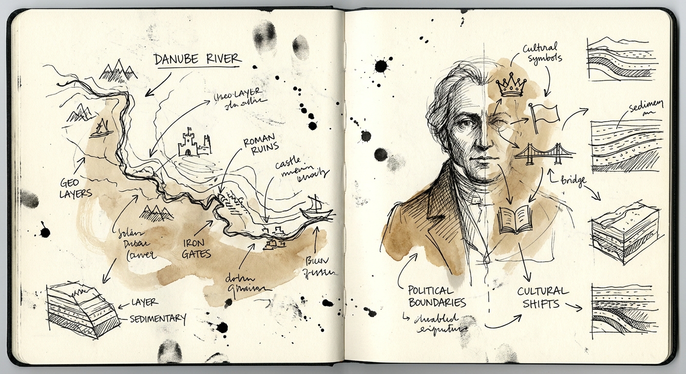
The Danube River: A Comprehensive Analysis of its Geological, Cultural, and Political History
This extensive report details how Europe's second-longest river has shaped civilizations, empires, and modern geopolitics, from its geological origins to its crucial role today.
Listen to this article
31 min listen
The Danube River: A Comprehensive Analysis of its Geological, Cultural, and Political History
The Danube River stands as the second-longest river system on the European continent, carving a 2,850-kilometer trajectory from its headwaters in the Black Forest of Germany to its expansive delta on the Black Sea. However, viewing the Danube strictly through the lens of physical geography fundamentally underestimates its role as the central circulatory system of European history. Throughout its existence, the river has oscillated between two contradictory strategic identities: it has acted as a formidable natural barrier separating civilizations and empires, and simultaneously as a highly efficient corridor for migration, commerce, and ideological transmission.
This dual nature has profoundly shaped the demographic, cultural, and political contours of dozens of nations. The river's banks have hosted the continent's earliest agricultural societies, witnessed the violent demarcation of the Roman frontier, facilitated the rapid spread of Christianity, and endured the mechanized brutality of modern global warfare. To understand the Danube is to understand the foundational mechanisms of European civilization itself. This report provides an exhaustive, multi-disciplinary analysis of the Danube River, synthesizing its geological genesis, its prehistoric settlement patterns, its influence on classical and medieval imperial hegemonies, and its critical role in forging the geopolitical landscape of modern Europe.
The Geological Evolution of the Danubian Basin
The geological narrative of the Danube is an intricate saga of tectonic plate collisions, extreme climatic oscillations, and the gradual dissolution of prehistoric inland seas. The modern river system and its fertile basins are the direct result of millions of years of sedimentation, tectonic subsidence, and hydrological capture.
The Tectonic Escapes and the Paratethys Sea
The broader structural buildup of the Danube and Transcarpathian basins is rooted in a complex history of tectonic escape, regional extension, and volcanic activity within the Pannonian Basin system, which sits nested between the European mountain ranges of the Carpathian arc, the Dinarides, and the Eastern Alps. The basement rocks of the Danube Basin—arranged in deep troughs and a massive central depression located beneath the modern Slovakian-Hungarian border—underwent massive subsidence, sinking to depths of up to eight kilometers below the modern surface. This tectonic activity created a basin capable of capturing immense volumes of water and sediment, recording a complex stratigraphic succession of deepening and shallowing sedimentary environments across epochs.
For millions of years, this geography was dominated by the Paratethys Sea, a massive, shallow inland body of water that once stretched continuously from the Alps into Central Asia. The earliest iterations of the Paleo-Danube delta formed approximately 11.5 million years ago along the northwestern margin of the Vienna Basin. During this specific epoch, a significant climatic lowstand of Lake Pannon (a massive brackish lake formed from the receding Paratethys) allowed the ancestral river to deposit massive sedimentary lobes. Extensive 3D seismic surveys and well-log data covering 600 square kilometers reveal that this primeval delta was heavily river-dominated, yet significantly influenced by wave-reworking processes.
Stratigraphic true vertical depth measurements indicate that the lake waters decreased from approximately 180 meters to 100 meters during the delta's mature phase. However, this deltaic formation was abruptly halted around 11.3 million years ago when a major lake-level rise flooded the basin margins. This hydrological shift forced the fluvial deposits to back-step into the North Alpine Foreland Basin, terminating delta deposition in the Vienna region and reshaping the river's flow dynamics.
The Dacian Basin and the Cimmerian Transgression
In the lower stretches of the river, the geological history is dominated by the evolution of the Dacian Basin, a large sub-basin of the Paratethys. During the early Pontian time, an abrupt drop in global sea levels caused the Paratethys to permanently separate into three distinct bodies: the Euxinian, Dacian, and Caspian basins. At the end of the Bosphorus time, the discharge of the Dacian Basin's waters into the Euxinian Basin carved a wide, powerful runoff valley stretching eastward through the Galati-Reni region and the Galati gateway.
This runoff valley became the site of intense biological and ecological migration during the subsequent Cimmerian transgression, a period of rising sea levels that formed a vast bay at the site of the modern Danube Delta. Mutual migrations of Dacian and Cimmerian molluscs occurred extensively along this waterway, driven by circular currents in the Euxinian Basin that mimic the hydrology of the modern Black Sea. The rhythmically bedded thick sedimentary strata that originated during the existence of this runoff valley are identified by geologists as the Pridanubian Formation, which is characterized by the presence of the cryptogenic mollusc form Tulotoma ovidii nasonis.
The precise dating of these Miocene and Pliocene formations has been achieved through advanced geochronological techniques. By integrating high-resolution astrochronology, cyclostratigraphy, and magnetostratigraphy, geologists have successfully isolated the primary Natural Remanent Magnetisation (NRM) components frozen in the sedimentary deposits. These techniques have allowed for the construction of an Astronomically Tuned Neogene Time Scale (ATNTS), providing researchers with an unprecedented framework for mapping the exact timing of the Dacian Basin's sedimentation. Over subsequent millennia, further geological phenomena such as stream capture—specifically where the ancestral Rhine River captured the original headwaters of the Danube—reduced the Danube's overall length and volumetric flow, finalizing the watershed boundaries that dictate modern European geography.
| Geological Epoch / Phase | Key Hydrological Event | Basin / Regional Impact | Associated Formations |
| Middle Miocene (~11.5 Ma) | Lowstand of Lake Pannon | Formation of the Paleo-Danube delta in the Vienna Basin; river-dominated deposition. | Topset and bottomset fluvial deposits. |
| Middle Miocene (~11.3 Ma) | Lake Pannon level rise | Flooding of Vienna Basin margins; back-stepping of deposits into the North Alpine Foreland. | Relocated fluvial stratigraphy. |
| Early Pontian | Paratethys sea-level drop | Separation of the Paratethys into the Euxinian, Dacian, and Caspian basins. | Dacian Basin isolation. |
| Late Bosphorus | Dacian water discharge | Formation of a wide runoff valley through the Galati gateway. | Galati-Reni valley carving. |
| Cimmerian Transgression | Sea-level rise and bay formation | Vast bay formed at the modern Delta; extensive migration of Dacian/Cimmerian molluscs. | Pridanubian Formation (Tulotoma ovidii nasonis). |
Prehistoric Foundations: The Cradle of European Agriculture
The geological stabilization of the Danube created a basin featuring highly fertile fluvial terraces, diverse microclimates, and abundant freshwater resources. Consequently, the river became the geographic incubator for some of Europe's earliest, most complex prehistoric societies. The transition from nomadic hunter-gatherer existence to organized, permanent agricultural communities in Europe was fundamentally catalyzed by the river's environment.
The First Temperate Neolithic Horizon
Between approximately 6200 and 4500 BCE, the region experienced the emergence of the First Temperate Neolithic horizon, characterized primarily by the Starčevo-Körös-Criş cultural complex. Centered around extensive land-use sites such as Zadubravlje, Galovo, and Stari Perkovci, these communities introduced intensive farming techniques to the Balkan peninsula. This foundational society was quickly succeeded and partially absorbed by the Linear Pottery culture (LBK), which utilized the stable terraces of the Danube to establish sophisticated longhouses and systematic crop cultivation. This transition marked a demographic explosion, fundamentally altering the social fabric of Central Europe.
The Vinča and Vučedol Civilizations
Following the Starčevo horizon, the Late Neolithic Vinča culture (dating from roughly 5300 to 4500 BCE) achieved absolute dominance over the central Balkans and the broader Danube valley. The Vinča civilization represented a profound, paradigm-shifting leap in social complexity. Settlements such as Vinča-Belo Brdo, Lepenski Vir, Vršac, and Belovode supported populations ranging from several hundreds to a few thousands of inhabitants, marking a definitive transition toward permanent, dense urbanization previously unseen in Neolithic Europe.
The Vinča culture is historically notable for two massive technological and cognitive innovations: early metallurgy and proto-writing. The culture produced some of the first known copper artifacts in the world, initiating a metallurgical tradition that would culminate centuries later in the Vučedol culture (3rd millennium BCE), which became renowned across the continent for its highly advanced ceramics and sophisticated metalwork. Furthermore, archaeologists have uncovered an extensive array of pottery and ritual artifacts bearing approximately 700 distinct carved characters and symbols. While the academic community is fiercely engaged in debate as to whether these symbols constitute a true, phonetically mapped writing system or simply represent a highly localized, conceptual symbology for trade and ritual, they remain some of the oldest continuous proto-writing systems ever discovered, challenging the narrative of Mesopotamian exclusivity in early linguistics.
Recent advances in zooarchaeological and biogeochemical analysis have provided a highly nuanced picture of Vinča agricultural and economic logistics. By measuring stable carbon ($ \delta^{13}\text{C} ) and oxygen ( \delta^{18}\text{O} $) isotopic signatures extracted from the incremental bioapatite in the teeth of domesticated livestock, researchers have decoded their complex herding strategies. The isotopic data reveals a low variation within sheep and goats, indicating they were grazed on seasonal halophyte plant communities in specific saline-rich environments. Conversely, cattle feeding strategies were highly variable; cattle were provided with supplementary winter forage, such as cut branches and leafy hay. This sharp, systematic distinction in livestock management suggests the emergence of highly organized, household-based economic control over cattle, indicating that cattle held both a central economic function and a profound symbolic role in establishing social hierarchies within Danubian societies.
For decades, the prevailing archaeological paradigm regarding these early communities was heavily influenced by Marija Gimbutas's "Old Europe" hypothesis, which posited that the prehistoric Danube was home to a peaceful, relatively homogeneous, and matriarchal society. According to this theory, this peaceful epoch was only shattered by the violent invasions of horse-riding Proto-Indo-European tribes from the Pontic-Caspian steppe. However, this romanticized framework has undergone massive revision since the 1990s. Emerging forensic evidence of violent massacres and the discovery of defensively enclosed, fortified settlements indicate that prehistoric Danubian life was fraught with intense inter-communal conflict, necessitating sophisticated defensive geography and militarized social organization long before the arrival of steppe nomads.
The Classical Epoch: Greek Trade and the Conceptual Ister
As human civilization advanced into the Iron Age and the classical antiquity period, the Danube—known to the ancient Greeks as the Ister and to the Romans as the Danubius—transitioned from a localized agricultural lifeline into a massive macroeconomic and geopolitical frontier.
The Greek Maritime Enclaves and Commercial Expansion
In the 7th century BCE, the archaic Greek expansion across the Mediterranean and Black Seas reached the mouth of the Danube. Driven by the need for raw materials and new markets, Ionian settlers originating from Miletus founded the polis of Istros (also known as Histria) just south of the sprawling Danube delta. Histria represents the first planned urban settlement in modern-day Romania, operating as a highly fortified, vital trading enclave.
The Greek colonists established a lucrative, systemic trade network with the local indigenous populations, primarily the Getae and Thracian tribes. Histria served as the funnel through which Mediterranean luxury goods—such as finely crafted pottery, bronze, silver vessels, wine, and olive oil—were exchanged for bulk commodities necessary for the Greek mainland, including grain, timber, and highly prized gold sourced from the deep Carpathian interior. The immense economic significance of the river to this trade was immortalized in the city's unique currency. The distinctive cast bronze double-headed coins of Istros have fascinated numismatists for decades; prevailing theories suggest that the dual-headed imagery represents the dual trade routes that fueled the city's massive prosperity—the east-west fluvial routes along the Danube River into the European interior, and the north-south maritime routes connecting back to Greece and the wider Mediterranean.
To the classical Greek intellectual mind, the Ister was an entity of almost mythical, continental proportions. The foundational historian Herodotus described the Ister as the greatest of all known rivers, noting that it flowed with equal volume year-round. Based on the limited geographical knowledge of the time, Herodotus theorized that the river originated in the far western land of the Celts, bisected the entire European continent, and possessed a sheer volume comparable only to the Nile. In the Hellenistic worldview, the river served as the ultimate conceptual boundary separating the known civilized world from the vast, desolate, and terrifying territories of the Scythians and unknown barbarian tribes to the north.
The Roman Limes: Imperial Engineering and Geopolitical Strategy
While the Greeks utilized the river primarily for commercial exploitation, the Roman Empire recognized the profound strategic, economic, and cultural value of the 1,800-mile-long river, permanently integrating it into its grand imperial strategy as the Limes Danubii (the Danubian frontier). Beginning under the reign of Emperor Augustus in 15 BCE, Rome systematically moved to secure strategically important chokepoints and trade routes along the river to shield the empire's vulnerable Mediterranean core from northern tribal incursions.
The physical environment of the Danube provided a formidable natural shield. Its sheer width, swift currents, and dangerous propensity to freeze treacherously in the winter—creating ice bridges that could break at any moment—made large-scale amphibious invasions incredibly difficult for barbarian forces. However, Rome viewed the Danube not as a static, peaceful border, but as a high-risk, highly volatile frontier zone. The empire utilized the vast territories of the Danubian provinces (including Raetia, Noricum, Pannonia, Moesia, Dacia, and Scythia Minor) to execute a defense-in-depth strategy, allowing the Roman Army to "trade space for time," absorbing external kinetic pressure while marshaling reinforcements. Because of the boggy, dendritic nature of the riverbanks, continuous earthen ramparts (like those built in Britain or along the Rhine) were impractical. Instead, the border was fortified with a highly sophisticated network of watchtowers, massive legionary camps (castra), and stone forts, all interconnected by a major military highway, the Via Istrum, which ran the entire length of the river to the delta.
The logistical machinery required to support this frontier was unparalleled in antiquity. The Danubian provinces were more heavily garrisoned with legions than any other frontier, serving as a vital recruitment ground for auxiliaries, particularly native cavalry and light infantry. Supplying these massive concentrations of troops—for example, over 16,000 soldiers stationed in Moesia Inferior alone—required extreme administrative efficiency and civilian integration. The Roman military established vast horrea (warehouses) to facilitate the long-term storage and distribution of grain and supplies. The river offered the cheap, bulk transportation of these goods. Rome's permanent professional navy managed specialized provincial river fleets (such as the Classis Pannonica and Classis Moesica), utilizing nimble two-tiered galleys (liburnae) to conduct rapid scouting, suppress piracy, and ensure the continuous flow of logistics. Imperial revenue was strictly managed through a network of customs houses (portoria), which levied tariffs ranging from 2.5% to 5% on commercial goods traversing the imperial boundary.
To project power directly across the river and execute punitive campaigns, Roman engineering achieved monumental, history-altering feats. The most notable of these was Constantine’s Bridge at Sucidava, completed in 328 CE. Stretching an astonishing 2,434 meters across the water, built with massive masonry piers and a towering wooden superstructure, it stood as the longest ancient river bridge ever constructed. The inauguration of this bridge, commemorated by gold medallions minted in Rome, symbolized the empire's enduring intent to project power into the northern "barbarian" lands.
Over centuries of occupation, the river incubated a unique, hybrid borderland culture. Major provincial capitals such as Carnuntum, Aquincum (Budapest), Singidunum (Belgrade), and Viminacium flourished not just as military garrisons, but as unofficial centers of diplomacy and massive commercial hubs. In these urban contact zones, Roman street grids merged seamlessly with local stone and pottery architectural styles, and religious temples housed syncretic deities, reflecting the assimilation of the Dacian, Sarmatian, and Germanic peoples into the broader Roman cultural sphere. Ultimately, however, the sheer, compounding demographic pressure of mass migrations overwhelmed the frontier's capacity. Following the relentless assaults of the Marcomannic Wars, the subsequent Gothic migrations, and the catastrophic Roman defeat at the Battle of Adrianople in 378 CE, the defensive line effectively collapsed. The river transitioned rapidly from an imperial shield into a wide-open migration corridor for the Huns, Goths, and Slavs, signaling the end of classical antiquity in the region.
Late Antiquity to the Middle Ages: The Spread of Christianity and the Holy Roman Empire
The collapse of the Roman Limes in the 5th century inaugurated a profound geopolitical and cultural shift. The Danube, having failed as a military barrier, was repurposed by historical forces into the primary artery for the ideological conquest of Europe: the rapid and comprehensive spread of Christianity.
From Natural Barrier to Missionary Highway
As migrating barbarian tribes—including the Vandals, Saxons, Burgundians, and Alemanni—infiltrated the remnants of the former empire, the heavily fortified Limes Germanicus and Limes Pannonicus were abandoned and fell into ruin. However, the physical infrastructure of the river and its adjacent Roman roads remained highly navigable, facilitating a new form of conquest. Operating outside the traditional Roman diocesan structure, Irish and Scottish monks utilized the river networks to pioneer the evangelization of the invading tribes.
These early, highly mobile missionaries, hailed by contemporary chroniclers as the "teachers of nations and disciplers of kings," moved rapidly along the "watery-highway," establishing a sequential chain of monasteries. They were soon followed by the Benedictines, who utilized the highly fertile river terraces to build expansive, economically self-sustaining monastic estates. In regions like Austria's Wachau Valley, these religious orders developed intricate terraced vineyards and agricultural centers, permanently transforming the river into a backbone for both theological dissemination, pilgrimage, and economic revitalization.
The architectural and cultural legacy of this era remains highly visible today. Modern river stopovers in cities such as Cologne, Würzburg, Bamberg, Nuremberg, Regensburg, Passau, Melk, and Vienna feature a staggering profusion of churches spanning Romanesque, Gothic, and Baroque styles. These structures stand as silent, enduring witnesses to the Christianization of the continent. This shared religious heritage laid a common cultural foundation, seamlessly linking disparate ethnic and linguistic groups, and fostering a nascent, interconnected European identity built upon Christian theology.
The Carolingian Artery
By the 9th century, the geopolitical reality of the Danube had completely transformed; it fully shed its identity as a boundary and assumed its role as the central, life-giving artery of the Kingdom of the Franks and the emerging Holy Roman Empire. Charlemagne, crowned the first Holy Roman Emperor, immediately recognized the immense strategic, military, and commercial potential of the river. To secure his eastern frontiers and facilitate the movement of armies and trade, he erected new, heavily fortified structures such as the Werfenstein fortress.
Charlemagne’s strategic vision extended far beyond immediate military concerns; he conceptualized a monumental, paradigm-shifting engineering project: a massive canal connecting the Rhine and the Danube rivers, designed to seamlessly link the maritime trade of the North Sea with the vast resources of the Black Sea. Although the extreme technical and hydrological limitations of medieval engineering prevented the successful completion of his project (a vision that would not be fully realized until the completion of the Rhine-Main-Danube Canal in 1992), Charlemagne’s ambition underscored the river's permanent transition from a line of division to the ultimate symbol of European unification and interdependence.
The Crusader Era: Holy War and Riverine Logistics
During the high Middle Ages, the intense religious fervor and military mobilization of the Crusades tested the logistical, diplomatic, and infrastructural capacities of the Danubian kingdoms. As the most direct overland route from Western Europe to the Byzantine Empire and the Levant, the river became a massive staging ground for holy war.
The First Crusade: Friction and the People's Crusade
The call for the First Crusade by Pope Urban II in 1095 initiated unprecedented mass movements of armed pilgrims along the river. The initial wave, commonly known as the People's Crusade (or the Peasants' Crusade), was led by charismatic preachers like Peter the Hermit and knights like Walter Sans Avoir. This force, numbering in the tens of thousands, was essentially an untrained peasant army lacking formal logistical support, supply trains, or unified command. Moving rapidly along the Rhine and down the Danube through Germany, Hungary, and Serbia, they relied entirely on foraging, the charity of local populations, and the surviving infrastructure of ancient Roman roads.
This massive, uncontrolled influx of unfunded soldiers immediately sparked severe diplomatic and physical friction. Historical chronicles, such as those by Albert of Aachen, indicate that as Peter the Hermit's vanguard approached the critical Hungarian-Byzantine frontier between Zemun and Belgrade, tensions boiled over into violence. The Byzantine commander of Belgrade, Niketas Karykes (referred to in Western sources as duke "Nichita"), reportedly colluded with a Hungarian border count named Guz to ambush and massacre the crusaders. Fearing the total disruption of local trade networks and seeking to strip the vulnerable pilgrims of their horses, gold, silver, and supplies, the frontier lords attacked the rear guard. Such violent conflicts highlighted the extreme volatility and danger of moving massive, unsupplied armies across sovereign medieval borders without pre-negotiated logistical frameworks.
The Systematic Logistics of the Second and Third Crusades
Learning from the chaotic and bloody failures of the First Crusade, the commanders of subsequent military expeditions treated the Danube route with rigorous, highly organized logistical planning. During the Second Crusade (1146–1147) and the Third Crusade (1189), European monarchs systematically negotiated safe passage, market privileges, and favorable money exchange rates with local sovereign rulers prior to departing their home territories.
For the Third Crusade, the Holy Roman Emperor Frederick I Barbarossa made a deliberate strategic choice to utilize the overland Danubian route. Economically, Germany lagged behind France and England, and Barbarossa sought to avoid competing with Richard the Lionheart and Philippe Auguste over the highly scarce, expensive maritime shipping capacity in the Mediterranean. Departing from Regensburg in the early summer of 1189 with a massive, highly disciplined army of approximately 3,000 knights and 12,000 well-armed foot soldiers, Barbarossa utilized the river to its absolute fullest tactical advantage.
The logistical execution was masterful. The emperor, his immediate entourage, and the incredibly heavy baggage train traveled continuously by a constructed fleet of river ships (naves), while the main army marched in coordinated detachments along the banks. This dual-movement strategy prevented the army from being caught in a "defeat in detail" scenario, ensuring that the infantry and the supply train arrived at choke points simultaneously.
Diplomacy was essential to maintaining this massive supply chain. The Hungarian King Bela provided Barbarossa's army with ships and wagons (plaustra) loaded with immense quantities of bread, wine, barley for the warhorses, and huge herds of oxen and sheep to feed the men. The river fleet transported heavy equipment seamlessly through the plains, but the physical geography of the Danube ultimately dictated the operational limits of medieval logistics. Upon reaching the Iron Gates just beyond Belgrade—a treacherous section of fast-flowing, narrow canyons that were completely unnavigable for heavy medieval vessels—the fleet was forced to halt. King Bela took his ships back to Hungary, the supplies were offloaded, and the crusading army proceeded entirely on foot into Byzantine territory, demonstrating the profound dictating power of the river's topography over human military endeavor.
The Crucible of Empires: The Ottoman-Habsburg Frontier
From the 14th to the late 19th centuries, the Danube basin violently reverted to its historical role as a heavily militarized, contested frontier. It became the primary, centuries-long theater of conflict between the expanding Islamic Ottoman Empire and the Christian Habsburg Monarchy, forging a deeply embedded legacy of militarization, demographic engineering, and profound cultural syncretism.
Ottoman Expansion and the Strategic Siege of Belgrade
The rapid, aggressive expansion of the Ottoman Empire into the Balkans fundamentally altered the geopolitics of the entire river basin. The Ottomans harnessed the diverse talents and raw manpower of their subject populations, utilizing a highly disciplined standing army—anchored by the elite Janissary infantry and the highly mobile Sipahi cavalry—to push steadily northward. The Danube quickly became the absolute northern bulwark of Islamic expansion into Europe.
A critical, continent-defining turning point occurred during the Siege of Belgrade (Nándorfehérvár) in July 1456. Recognizing that Belgrade was the definitive strategic key required to control the Middle Danube and launch invasions into the Hungarian plains and Central Europe, Sultan Mehmed II blockaded the city. The Ottoman forces deployed a massive, state-of-the-art artillery train and a massive river fleet of over 200 vessels to cut off the city. However, the Hungarian defense, brilliantly commanded by John Hunyadi and bolstered by fervent crusader militias led by John of Capistrano, successfully repelled the Ottoman assaults in a decisive, crushing victory. This victory temporarily halted the Ottoman advance into Europe for several decades. Nonetheless, the geopolitical pressure was inexorable; by 1541, the Ottomans had successfully captured Buda, cementing their absolute dominance over the middle and lower Danube, which they secured with heavily garrisoned fortresses such as Golubac, Vidin, and Silistra, supported by patrols of riverine gunboats.
The Habsburg Militärgrenze (Military Frontier)
In direct response to the existential Ottoman threat, the Habsburg Monarchy engineered the Militärgrenze (Military Frontier), a highly organized, heavily fortified defensive buffer zone that eventually spanned from the Adriatic Sea all the way to the Carpathian Mountains. This frontier was systematically populated by a diverse array of colonists—including Serbs, Croats, Vlachs, and later, recruited German settlers known as the Donauschwaben. In a sophisticated system of military feudalism, these populations were granted free land, religious freedom, and highly favorable tax exemptions in exchange for lifelong, hereditary military service as border guards.
The establishment of the Military Frontier catalyzed massive, permanent demographic shifts across the region. Fleeing continuous Ottoman reprisals and harsh taxation, hundreds of thousands of Serbs migrated en masse across the Danube and Sava rivers into Habsburg territory, most notably during the Great Migrations of the Serbs in the late 17th century. This massive influx permanently altered the ethnic and religious composition of regions like Vojvodina and Slavonia, formally embedding a deeply rooted Orthodox Christian population within the strictly Catholic Habsburg realm, and laying the demographic groundwork for the ethnic complexities of the modern Balkans.
Beyond pure military defense, the Militärgrenze functioned as a massive, state-controlled cordon sanitaire. Recognizing the devastating economic and demographic threat of the plague and other infectious diseases constantly emanating from the Ottoman lands, the Habsburgs enforced a draconian, highly regulated border regime. Influenced by the prevailing economic doctrine of mercantilism—which posited that a large, healthy population was the absolute key to state power and economic self-sufficiency—the military infrastructure was utilized to implement one of the earliest, most expansive state-sponsored epidemiological defense systems in history. Migrants and merchants crossing the Danube were subjected to extremely strict quarantine times at border stations, sometimes lasting up to 84 days for people and an astonishing 168 days for specific trade goods.
Cultural Integration and the Ottoman Legacy
Despite the continuous, brutal state of warfare and strict border controls, the Danube facilitated a vibrant, unstoppable cross-cultural exchange that permanently left an Oriental-Balkan imprint on Central and Eastern European society.
The Ottoman architectural and cultural legacy remains highly visible in major Danubian cities today. In Belgrade, structures such as the Bajrakli Mosque (built around 1575), the heavily modified Kalemegdan fortress, the Mehmed Pasha Sokolović fountains, and the cobblestone streets of the Skadarlija district exhibit deep, enduring Ottoman influences. Similarly, the town of Silistra in Bulgaria evolved entirely around its identity as a major Ottoman trade center and military fortress guarding the lower river.
The cultural exchange penetrated deep into the heart of the Habsburg empire itself. The bustling port area of 18th-century Vienna became an epicenter of Ottoman-European integration. Following the liberal economic reforms of the 1770s, highly skilled Greek and Ottoman merchants established thriving, deeply interconnected diaspora communities within Vienna. They integrated seamlessly into the local economy via established merchant guilds, dominating the lucrative import of specific trade goods such as red cotton yarn.
This physical and economic presence sparked a massive cultural phenomenon among the European elite known as "The Orient in Vienna," which rapidly reshaped the social fabric of the city. The most famous and enduring legacy of this cross-cultural integration was the emergence of the Viennese coffeehouse culture. A direct import of Ottoman social habits, the consumption of coffee (and newly introduced delicacies like ice cream) transformed the coffeehouse into the primary site of public sociability, intellectual exchange, and political discourse, becoming the absolute bedrock of Enlightenment-era public life in Central Europe.
The Forging of Modern Europe: Internationalization, Conflict, and Ecology
The technological, political, and industrial revolutions of the 19th and 20th centuries transformed the Danube from an imperial battleground into a heavily engineered, internationally governed resource. However, its immense strategic value ensured that it remained highly susceptible to the catastrophic ravages of global warfare and geopolitical division.
Engineering, Treaties, and Supranational Governance
Following the conclusion of the Crimean War, the 1856 Treaty of Paris marked a watershed moment not just for the river, but for the history of international law. The treaty explicitly established the European Commission of the Danube (CED), the very first international body granted significant, legally binding supranational powers over a shared sovereign waterway. Comprising the riverine nations as well as the major maritime superpowers of the era, such as Great Britain and France, the Commission was explicitly tasked with guaranteeing absolute freedom of navigation and commerce along the river for all European nations.
This new legal framework necessitated massive, unprecedented physical alterations to the river's hydrology. Between 1870 and 1875, extensive state-sponsored dredging and canalization projects tamed the river's wild, natural meanders. Particularly around Vienna, engineers drastically narrowed the river's floodplain to stabilize deep-water shipping routes and prevent the catastrophic seasonal flooding that had plagued the region for centuries. Culturally, this era of stability and engineering triumph romanticized the river, a sentiment perfectly captured by Johann Strauss II's 1867 waltz, "The Blue Danube," which embedded the river into the global cultural consciousness as the ultimate symbol of elegance, peace, and imperial Austrian prestige.
| Treaty / Agreement | Year | Geopolitical Significance and Outcome |
| Treaty of Paris | 1856 | Settled the Crimean War; established the European Commission of the Danube; the first international body governing a shared river to guarantee free commerce. |
| Definitive Status Convention | 1921 | Re-established unrestricted navigation following the devastation of WWI; opened the river to all global flags on a footing of complete equality. |
| Vienna Conference | 1940 | Nazi Germany forced the legal revocation of the 1921 Convention, placing the entire river system under total Axis control. |
| Belgrade Convention | 1948 | Shifted control exclusively to riparian states; forcibly removed non-river Western powers; split administration during the Cold War era. |
| Danube River Protection Convention | 1994 | Established integrated environmental management and led to the creation of the ICPDR to combat basin-wide pollution. |
The Crucible of Global Conflict (WWI and WWII)
During the horrific conflicts of the 20th century, the strategic value of the Danube made it a primary artery of logistics, violence, and economic survival in both World Wars. In World War I, control of the river crossings was fiercely contested by massive industrialized armies. In October 1916, the Battle of Cinghinarele Island perfectly demonstrated this; Austro-Hungarian and German river monitors launched a coordinated bombardment against Romanian artillery positions to secure a vital chokepoint. Capturing this island ensured the unimpeded movement of the Central Powers' Danube flotilla and prevented Romanian troops from cutting off critical supply lines.
World War II brought unprecedented, industrialized devastation to the river and its infrastructure. Nazi Germany systematically dismantled the international river commissions, achieving total, absolute control of the Danube by 1940 through the violent annexation of Austria, the brutal invasion of Yugoslavia, and coerced, unequal treaties with Hungary and Romania. The river instantly became the central logistical lifeline for the Axis war machine, specifically utilized for transporting millions of barrels of crude oil from the massive Ploiești refineries in Romania directly to the German industrial homeland.
Recognizing that this oil supply was the lifeblood of the German military, the United States Army Air Forces launched "Operation Tidal Wave" on August 1, 1943. Deploying 177 heavily armed B-24 Liberators from bases in Libya, the Allies bombed the Romanian refineries in what became one of the costliest and bloodiest air raids of the entire war. The USAAF lost 53 aircraft and over 300 airmen to intense, highly concentrated German and Romanian anti-aircraft fire. Despite the heroism of the crews, the raid resulted in no massive curtailment of overall product output, as the Axis quickly repaired the facilities and continued to utilize the river network for transport.
The most haunting, physical legacy of WWII on the Danube occurred in late 1944 near the town of Prahovo, Serbia. As the Soviet Red Army rapidly advanced into the Balkans, the retreating German Black Sea fleet found itself completely trapped by the advancing front. Under direct orders to prevent the ships from falling into Soviet hands, German forces scuttled over 200 warships, barges, and torpedo boats, arranging them in a deliberate zigzag formation across the riverbed to severely obstruct the Soviet naval advance. Today, this act of desperation continues to haunt the river. During severe summer droughts exacerbated by global climate change, the rusting hulls, command bridges, and gun barrels of these Nazi vessels continue to breach the surface. Still loaded with unexploded ordnance, these wrecks narrow the navigable shipping channel from 180 meters to a highly dangerous 100 meters, posing severe explosive and navigational hazards to modern commercial shipping.
The Cold War and Modern Environmental Integration
The conclusion of World War II physically and ideologically fractured the Danube. The imposition of the Iron Curtain sharply divided the river basin between the Capitalist West and the Communist East, severely constraining transnational data exchange, economic cooperation, and environmental management. The 1948 Belgrade Convention fundamentally altered the river's legal governance; dominated by the Soviet bloc, the convention shifted control exclusively to the riparian states, forcibly expelling Western powers like France and Great Britain from the commission and effectively weaponizing the river's administration.
Rapid, unchecked heavy industrialization during the Cold War era led to severe, basin-wide ecological degradation. The river was poisoned by untreated urban wastewater, massive agricultural chemical runoff, and the construction of colossal hydroelectric dams, such as the Iron Gate, which fundamentally altered sediment transport, destroyed wetland habitats, and permanently blocked ancient fish migration routes.
However, the dramatic fall of the Iron Curtain in the late 1980s and early 1990s catalyzed a new, unprecedented era of basin-wide cooperation and ecological healing. Recognizing that water pollution respects no sovereign borders, the 1994 Danube River Protection Convention established the International Commission for the Protection of the Danube River (ICPDR). This organization successfully united the 14 basin countries and the European Union in a legally binding commitment to restore water quality, manage cross-border flood risks, and ensure highly sustainable environmental practices across the continent. Furthermore, the completion of the massive Rhine-Main-Danube Canal in 1992 finally realized Charlemagne's medieval dream, creating a continuous, highly efficient navigable waterway stretching from the North Sea port of Rotterdam all the way to the Black Sea, firmly re-establishing the river as the ultimate artery of a unified Europe.
Conclusion
The Danube River is not merely a geographic or geological feature of the European landscape; it is the physical, flowing manifestation of the continent's history. From the ancient tectonic rifts that isolated the Paratethys Sea to the deposition of highly fertile soils that birthed the metallurgical and linguistic innovations of the Vinča civilization, the river's deep geology explicitly dictated the parameters of human development. Throughout classical antiquity and the violent Middle Ages, the river's sheer scale forced it to act as a militarized frontier for the Roman, Byzantine, Ottoman, and Habsburg empires, while its navigable waters simultaneously functioned as the primary, unstoppable conduit for the spread of Christianity, the logistics of holy war, and profound cultural synthesis.
In the modern era, the Danube brilliantly reflects the complex trajectory of international law, industrialized warfare, and environmental consciousness. The transition from the violent, imperial conquests of the World Wars to the collaborative, supranational governance of the European Commission of the Danube and the ICPDR highlights a profound, optimistic shift in global geopolitical strategy. Despite bearing the physical scars of ancient battles and the rusted hulks of modern warfare, the river stands today as a vital economic lifeline and the most enduring symbol of a unified, interconnected Europe, its currents continuously carrying the deep, complex memory of the civilizations that have risen and fallen along its banks.
Works cited
- Danube - Wikipedia, https://en.wikipedia.org/wiki/Danube 2. The flow of Danube cooperation: a history of shared responsibility | ICPDR, https://www.icpdr.org/publications/flow-danube-cooperation-history-shared-responsibility 3. From barrier to highway, Evangelical Focus, https://evangelicalfocus.com/window-on-europe/2902/from-barrier-to-highway 4. The History & Culture of the Danube River, https://danubecruise.eu/danube/the-history-culture-of-the-danube-river/ 5. The Danube, an Empire Boundary River: Settlements, Invasions, Navigation, and Trade Pathway - Scirp.org., https://www.scirp.org/journal/paperinformation?paperid=103842 6. History and structure of the Danube and Transcarpathian basins in Slovakia - GeoERA, https://geoera.eu/blog/history-and-structure-of-the-danube-and-transcarpathian-basins-in-slovakia/ 7. Late miocene evolution of the Paleo-Danube Delta (Vienna Basin, Austria), https://opac.geologie.ac.at/ais312/dokumente/Paleo-Danube%20Delta.pdf 8. The Pliocene deposits of the Black Sea Shelf east of the Danube River Delta | Geological Society, London, Special Publications - Lyell Collection, https://www.lyellcollection.org/doi/abs/10.1144/SP505-2019-102 9. DACIAN BASIN - GeoEcoMar, https://www.geoecomar.ro/website/docs/cartea-jipa.pdf 10. Starčevo culture - Wikipedia, https://en.wikipedia.org/wiki/Star%C4%8Devo\_culture 11. Of herds and societies—Seasonal aspects of Vinča culture herding and land use practices revealed using sequential stable isotope analysis of animal teeth - PMC, https://pmc.ncbi.nlm.nih.gov/articles/PMC8496836/ 12. Uncovering prehistoric Danube culture | ICPDR - International ..., https://www.icpdr.org/publications/uncovering-prehistoric-danube-culture 13. Vinča culture | Anthropology | Research Starters - EBSCO, https://www.ebsco.com/research-starters/anthropology/vinca-culture 14. Vinča culture - Wikipedia, https://en.wikipedia.org/wiki/Vin%C4%8Da\_culture 15. Greek colonisation - Wikipedia, https://en.wikipedia.org/wiki/Greek\_colonisation 16. Istrus | History | Research Starters - EBSCO, https://www.ebsco.com/research-starters/history/istrus 17. Histria (ancient city) - Wikipedia, https://en.wikipedia.org/wiki/Histria\_(ancient\_city) 18. Ancient Greek Colonization and Trade and their Influence on Greek Art, https://www.metmuseum.org/essays/ancient-greek-colonization-and-trade-and-their-influence-on-greek-art 19. The Mystery of the Double-Headed Coins of Ancient Istros - CoinWeek, https://coinweek.com/the-mystery-of-the-double-headed-coins-of-ancient-istros/ 20. River Ister: Significance and symbolism, https://www.wisdomlib.org/concept/river-ister 21. (PDF) Imagining the Ister/Danube in Ancient Thought and Practice ..., https://www.researchgate.net/publication/330339564\_Imagining\_the\_IsterDanube\_in\_Ancient\_Thought\_and\_Practice\_River\_the\_Scordisci\_and\_Creation\_of\_Roman\_Imperialistic\_Space 22. The Greek Peninsula and Interior Europe (Book 4) - A Guide to the Geography of Pliny the Elder - Cambridge University Press & Assessment, https://www.cambridge.org/core/books/guide-to-the-geography-of-pliny-the-elder/greek-peninsula-and-interior-europe/7E4C48C640D8494CC94586F73BC15288 23. Why Was the Danube Frontier So Important During the Roman ..., https://www.thecollector.com/danube-frontier-during-roman-empire/ 24. On the border of the empire - The Roman Limes | Römerstadt Carnuntum, https://www.carnuntum.at/en/magazine/on-the-border-of-the-empire-the-roman-limes/734 25. Danubian Limes - Wikipedia, https://en.wikipedia.org/wiki/Danubian\_Limes 26. Danube, Limes & Logistics. Some thoughts on Roman army supply in Moesia Inferior, https://www.academia.edu/35589371/Danube\_Limes\_and\_Logistics\_Some\_thoughts\_on\_Roman\_army\_supply\_in\_Moesia\_Inferior 27. The Crusades - Jewish Virtual Library, https://jewishvirtuallibrary.org/the-crusades 28. People's Crusade - Wikipedia, https://en.wikipedia.org/wiki/People%27s\_Crusade 29. How did people on crusades from Europe know which route to use to get to Jerusalem? Were roads mapped out or signs in place that said Jerusalem this way? : r/AskHistorians - Reddit, https://www.reddit.com/r/AskHistorians/comments/ox8pjf/how\_did\_people\_on\_crusades\_from\_europe\_know\_which/ 30. Chapter 26 The First Five Crusades and Eastern Europe in - Brill, https://brill.com/view/book/9789004395190/BP000034.xml 31. Logistics of the early Crusades in the Balkans on Via Militaris, https://www.austriaca.at/0xc1aa500e\_0x002a7eca.pdf 32. Episode 65 - The Third Crusade • History of the Germans Podcast, https://historyofthegermans.com/65-2/ 33. Collections: Logistics, How Did They Do It, Part III: On the Move, https://acoup.blog/2022/08/12/collections-logistics-how-did-they-do-it-part-iii-on-the-move/ 34. The Impact of the Ottoman Era on Modern Political and Cultural Landscapes in Eastern Europe | Free Essay Example for Students - Aithor, https://aithor.com/essay-examples/the-impact-of-the-ottoman-era-on-modern-political-and-cultural-landscapes-in-eastern-europe 35. The Ottomans: A Cultural Legacy | Path to the Maypole of Wisdom, https://maypoleofwisdom.com/the-ottomans-a-cultural-legacy/ 36. Ottoman Empire - Military, Janissaries, Sipahis - Britannica, https://www.britannica.com/place/Ottoman-Empire/Military-organization 37. Siege of Belgrade (1456) - Wikipedia, https://en.wikipedia.org/wiki/Siege\_of\_Belgrade\_(1456) 38. Silistra | Danube River, Ottoman Empire, Fortified City | Britannica, https://www.britannica.com/place/Silistra 39. Military Frontier - Wikipedia, https://en.wikipedia.org/wiki/Military\_Frontier 40. The Military Frontier and Emigration Challenges in the 18th Century - Books of Jeremiah, https://booksofjeremiah.com/post/military-frontier-emigration-challenges-18th-century/ 41. The Habsburg Military Frontier (Chapter 3) - Imperial Borderlands, https://www.cambridge.org/core/books/imperial-borderlands/habsburg-military-frontier/CD645C2C5905854C8EB2ED39B14A7379 42. Great Migrations of the Serbs - Wikipedia, https://en.wikipedia.org/wiki/Great\_Migrations\_of\_the\_Serbs 43. Monitoring migrations: the Habsburg-Ottoman border in the eighteenth century - Scholarly Publications Leiden University, https://scholarlypublications.universiteitleiden.nl/access/item%3A2978141/view 44. Ottoman-Balkan Architecture in Serbia | PDF - Scribd, https://www.scribd.com/document/881861518/A-Kadijevic-Ottoman-Balkan-Style-in-Serb 45. Belgrade's Architectural Melange: From Ottoman Influences to Modernism, https://www.europaadventure.com/en/serbia/belgrades-architectural-melange-from-ottoman-influences-to-modernism/ 46. OTTOMAN ARCHITECTURE - beotura, https://beotura.rs/en/osmanska-arhitektura/ 47. A case of urban integration: Vienna's port area and the Ottoman ..., https://www.cambridge.org/core/journals/urban-history/article/case-of-urban-integration-viennas-port-area-and-the-ottoman-merchants-in-the-eighteenth-century/37D82BC68044C611F851DE0DF86DBF11 48. World War I on the Danube River - Europe Between East And West, https://europebetweeneastandwest.wordpress.com/tag/world-war-i-on-the-danube-river/ 49. Axis control of the Danube - Wikipedia, https://en.wikipedia.org/wiki/Axis\_control\_of\_the\_Danube 50. The History of the Danube - Riviera Travel, https://www.rivieratravel.co.uk/blog/the-history-the-danube 51. Oil & War - Marine Corps University, https://www.usmcu.edu/Portals/218/Oil%26War\_Web\_1.pdf 52. German Foreign Policy towards the Romanian Oil during 1938-1940 - International Journal of Social Science and Humanity, https://www.ijssh.org/papers/255-S00048.pdf 53. Operation Tidal Wave - Wikipedia, https://en.wikipedia.org/wiki/Operation\_Tidal\_Wave 54. Climate artefacts: How Nazi warships resurfaced in the Danube - Al Jazeera, https://www.aljazeera.com/features/2022/11/8/climate-artefacts-how-nazi-warships-resurfaced-in-the-danube 55. Wrecks of Nazi ships sunk during World War II emerge in River Danube following summer drought - CBS News, https://www.cbsnews.com/news/nazi-ships-world-war-danube-river/ 56. Europe drought: Low water on Danube river reveals sunken WW2 German warships, https://www.youtube.com/watch?v=PSYlQXmb1M0