
The Geopolitical and Demographic Nexus of the Rhine-Danube Corridor: A Historical Geography
Explore how the narrow terrestrial gap between Europe's two greatest rivers shaped millennia of conflict, migration, and integration.
Listen to this article
38 min listen
**# The Geopolitical and Demographic Nexus of the Rhine-Danube Corridor: A Historical Geography
Introduction: The Hydrological Imperative of the European Continent
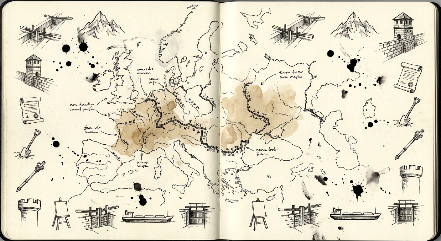
The physical and political geography of the European continent is fundamentally defined by its complex hydrographic networks, with the Rhine and Danube rivers functioning as the primary circulatory arteries of the landmass. Flowing in opposing directions from their respective origins in the alpine and sub-alpine regions of Central Europe—the Rhine discharging northwest toward the North Sea, and the Danube flowing southeast toward the Black Sea—these two massive river systems effectively bisect the continent. At their closest navigable proximity, located within the topographical confines of the Swabian and Franconian landscapes in modern-day Bavaria, the watersheds of the Rhine (primarily via the Main and Regnitz tributaries) and the Danube (via the Altmühl tributary) are separated by a remarkably narrow terrestrial gap.
This precise geographical bottleneck, straddling the Central European Watershed, has exerted a profound and continuous influence on the geopolitical, demographic, and cultural development of Europe from classical antiquity through the modern era. Because riverine transport in the pre-industrial era provided the only cost-effective means of moving bulk goods, military supplies, and mass populations over long distances, the interruption of navigability between the Rhine and the Danube created a permanent strategic anomaly for continental empires. This terrestrial gap forced political entities to make momentous strategic choices: they either had to heavily fortify the space to prevent enemy incursions, bridge the gap through overland portage and complex legal infrastructure to synthesize a unified economic zone, or engineer hydrographic connections to link the two river basins entirely.
Through an exhaustive examination of the historical geography of the Rhine-Danube corridor, it becomes evident that the closeness of these rivers shaped the defensive architecture of the Roman Empire, facilitated the ethno-linguistic migrations of late antiquity, dictated the decentralized political evolution of the Holy Roman Empire, and inspired millennia of hydro-engineering ambitions from Charlemagne to the modern European Union. The proximity of these rivers is not merely a topographical curiosity; it is the central geographical axis upon which European integration, population development, and political expansion have historically turned. The ability to harness the combined potential of these two river basins has long captivated the imagination of European leaders, driving centuries of conflict, innovation, and statecraft.
Geographical and Hydrological Parameters of the Continental Divide
To understand the historical forces at play, one must first delineate the precise hydrological and topographical parameters of the region. The Rhine basin encompasses a massive drainage area of approximately 185,000 square kilometers. The river begins in the Swiss Alps, specifically the canton of Graubünden, and forms a critical boundary through Western Europe before terminating in the Netherlands. Conversely, the Danube begins at the confluence of the Brigach and Breg Rivers in the Black Forest of Baden-Württemberg, Germany. The German portion of the Danube catchment area alone covers about 56,200 square kilometers, which represents only roughly seven percent of the river's total massive catchment area before it empties into the Black Sea in Romania.
The critical intersection of these two basins occurs in the Swabian and Franconian Alb, the Oberpfälzer region, and the Bavarian foothills. The topography of this region is characterized by significant elevation changes, ranging from 85 meters above sea level in the Upper Rhine Graben to over 2,900 meters at the Zugspitze in the Wetterstein Mountains. However, the terrestrial gap between the navigable tributaries—specifically the Swabian Rezat (flowing to the Main and Rhine) and the Altmühl (flowing to the Danube)—features a relatively low-lying watershed division.
This region is subject to distinct climatic variations that have historically impacted riverine logistics. The average annual temperature for the German Danube basin is approximately 7.8 °C, with precipitation averaging 991 millimeters per year. However, the climate has not been static. Historical records, such as the 1845 Bavarian Animal Observation Dataset, indicate that the region experienced the latter stages of the Northern Hemispheric Little Ice Age during the 19th century, with harsh winters and cold climates frequently cited as major environmental stressors. These fluctuating climatic conditions, combined with the complex natural dynamics of the rivers—including shifting shoals, heavy quartz grain sediment loads, and lateral erosion—created a highly dynamic and often treacherous environment for early navigators and engineers attempting to bridge the watershed.
The Roman Frontier and the Strategic Geometry of the Limes
During the expansionist phases of the Roman Empire, imperial grand strategy was intrinsically tied to natural geographic barriers. Following the stabilization of the northern frontiers by Emperor Augustus between 15 BCE and 15 CE, the Rhine and the Danube were established as the primary demarcation lines separating the Roman provinces of Gaul, Raetia, Noricum, and Pannonia from Magna Germania. This vast frontier, known as the Limes Germanicus and the Danubian Limes, relied on the rivers not only as physical moats against Germanic tribal incursions but also as critical logistical highways.
Logistical Dependencies and Riverine Infrastructure
The Roman military apparatus required immense volumes of grain, timber, metal, and manpower. Overland transport in antiquity was prohibitively expensive and slow, meaning that the viability of the frontier garrisons depended almost entirely on riverine shipping. The Rhine and Danube fleets (Classis Germanica and Classis Pannonica) patrolled the waters, ensuring that bulk goods moved efficiently between the interior provinces and the legionary fortresses situated along the riverbanks. The rivers also supported a highly lucrative network of customs houses (portoria) that collected duties on trade crossing into the empire, typically at a rate of 2.5% to 5%, generating significant revenue for the imperial treasury.
The defensive architecture of the frontier was formidable. The backbone of the Danube defense system, for example, consisted of a string of legionary fortresses, each housing between 5,500 and 6,000 Roman citizens as soldiers. A complex Roman road, the Via Istrum, was laid parallel to the limes to link stations, camps, and forts all the way to the Danube Delta.
| Roman Province | Legionary Allocation | Geographic Focus | Strategic Objective |
|---|---|---|---|
| Raetia | One Legion | Upper Danube / Alpine approaches | Control Alpine passes; secure the western flank of the Danubian plain. |
| Noricum | One Legion | Middle Danube / Modern Austria | Protect the transalpine trade routes; buffer against Germanic tribes. |
| Pannonia Superior | Two Legions | Lower-Middle Danube | Defend against powerful neighbors like the Sarmatians; anchor the eastern frontier. |
| Pannonia Inferior | Two Legions | Lower Danube / Balkans | Secure the deep Balkan interior and Black Sea approaches. |
However, the geographic orientation of the Rhine and Danube presented a severe strategic vulnerability. In their upper reaches, the two rivers diverge, creating an obtuse angle that cut deep into Roman territory to the southwest. This terrestrial gap between the navigable upper Rhine and the upper Danube lacked the natural defensive characteristics of the deep river valleys and was highly susceptible to barbarian penetration.
The Annexation and Abandonment of the Agri Decumates
To rectify this geometric and strategic vulnerability, the Romans under the Flavian emperors (beginning around 74 CE) advanced across the upper Rhine and Danube to annex the re-entrant angle, a region famously referred to by the historian Tacitus as the Agri Decumates (the "Tithe Lands"). Encompassing the Black Forest, the Swabian Jura, and the Franconian Jura, this territory was heavily fortified to shorten the lines of communication between the Rhine and Danube armies. The exact meaning of Decumates remains debated; some classicists, like Michael Grant, suggest it derives from an ancient Celtic term indicating a political division of "ten cantons," while others propose it implies a region where residents paid a tithe.
The occupation of the Agri Decumates represented a monumental shift from utilizing natural riverine borders to imposing an artificial, engineered frontier upon the landscape. The Romans built extensive road networks for rapid military movements and constructed watchtowers, earthen ramparts, and palisades. Later, under Emperor Trajan, these initial earthen camps were enclosed by robust stone walls.
Despite these extraordinary engineering efforts, the terrestrial nature of the Agri Decumates proved untenable during periods of acute imperial crisis. By 259–260 CE, under the relentless pressure of the Alemannic confederation and exacerbated by internal Roman strife, Emperor Gallienus was forced to evacuate the region, pulling the imperial defenses back to the natural boundaries of the Rhine and Danube. While later emperors, notably Diocletian and Maximian, launched punitive campaigns into the Agri Decumates in 288 CE in an attempt to reassert control, these successes were short-lived.
The second-order implication of this retreat was profound: by permanently abandoning the Agri Decumates, Rome conceded the vital terrestrial bridge between the two great rivers to Germanic tribes. This geographic concession created a demographic pressure cooker that would eventually facilitate the fall of the Western Roman Empire. The Rhine-Danube proximity thus proved to be the hinge upon which Roman continental security ultimately broke, transitioning the region from a fortified borderland into a staging ground for mass migration.
The Migration Period, Demographic Upheaval, and the Frankish Synthesis
With the collapse of the Roman frontier, the Swabian-Franconian gap transitioned from a militarized buffer zone into a primary conduit for ethno-linguistic migration. During the 3rd to 5th centuries, tribes such as the Alemanni and the Suebi expanded through the upper Rhine and upper Danube regions, settling in the fertile valleys and fundamentally altering the demographic landscape.
Demographic Crash and Recovery
The transition from late antiquity to the Early Middle Ages was marked by severe demographic volatility in the Rhine-Danube corridor. Modern geoarchaeological modeling and paleodemography in regions closely tied to the Rhine delta reveal drastic population fluctuations. The first millennium AD was characterized by a major population peak during the middle-Roman period (70–270 AD), followed by a catastrophic demographic decline of up to 78 percent as the empire fragmented and urban centers were abandoned. The population levels in Europe from 200 to 600 AD experienced a severe overall decline, only stabilizing at a low level from 600 to 1000 AD with intermittent growth.
The proximity of the two river systems allowed the migratory Germanic tribes to rapidly establish a broad territorial footprint that bridged the continental watershed, capitalizing on the abandoned Roman infrastructure. However, the political autonomy of these tribal confederations was relatively short-lived. By the year 500 CE, the Franks under King Clovis I had decisively defeated the Alemanni, incorporating the critical Rhine-Danube corridor into the expanding Merovingian kingdom.
Legal Codification and Religious Assimilation
This political unification of the Rhine and upper Danube basins under a single authority was a watershed moment in European history. It laid the geopolitical foundation for the future Holy Roman Empire. Clovis and his successors utilized a sophisticated strategy of legal and religious assimilation to control the newly conquered populations and synthesize a cohesive society across the riverine gap.
The codification of the Pactus Alamannorum (early 7th century, under Chlothar II) and the subsequent Lex Alamannorum (circa 730 CE, widely attributed to Duke Lantfrid) effectively integrated Alemannic customary law with Frankish imperial directives. These extensive legal codes regulated minute details of daily life and ecclesiastical administration. For example, the Lex Alamannorum meticulously detailed the concept of church asylum: pursuers were forbidden from removing a fugitive from a church by force, and penalties for violating this asylum were set at 36 solidi to the church and an additional 40 solidi to the civil authorities. It also contained strict penalties for violence against women, levying fines of 12 solidi for uncovering a woman's head or lifting her dress, and 40 solidi for rape, with penalties doubling if the victim was married.
By forcing the Alemanni and other tribes into a shared legal code modeled on the Lex Salica of the Franks, the Merovingian and early Carolingian rulers mitigated the old tribal confederations of Germania and instituted a unified, written legal tradition across the watershed.
Concurrent with this legal integration was the systematic Christianization of the region. The rivers served as the primary vectors for the spread of Catholicism during the Early Middle Ages. Irish and Anglo-Saxon missionaries, heavily supported by Frankish monarchs who viewed Christianity as an essential tool of political legitimacy, traveled along the Rhine and the Danube to establish vast monastic networks. Abbeys such as St. Gall and Reichenau became pivotal cultural and economic nodes, transforming the previously pagan wilderness into a highly structured, agrarian society.
The ecclesiastical elite became significant users of the river networks, utilizing ships to transport passengers and distribute agricultural income across their widespread domains. A 9th-century account in the Miracula Sancti Goaris details an abbot shipping wine barrels downstream on the Rhine, illustrating how the rivers functioned as economic lifelines for the church. This period solidified a third-order geopolitical reality: while the Roman Empire viewed the Rhine and Danube as external borders to be defended, the emerging Germanic kingdoms viewed the rivers and the gap between them as the central nervous system of their civilization.
Carolingian Ambitions: The Fossa Carolina and Economic Bifurcation
As the Frankish realm evolved into the Carolingian Empire under the formidable leadership of Charlemagne, the strategic necessity of physically connecting the Rhine and Danube basins became an obsession. In 792–793 CE, Charlemagne initiated one of the most ambitious and visionary hydro-engineering projects of the entire Middle Ages: the Fossa Carolina (or Karlsgraben). Recognizing the tantalizing geographical proximity of the Swabian Rezat (which flows via the Regnitz and Main to the Rhine) and the Altmühl (which flows directly to the Danube near Kelheim), Charlemagne ordered the excavation of a navigable canal to permanently bridge the Central European Watershed.
The Geopolitics and Engineering of the Fossa Carolina
The motivation for the Fossa Carolina was multifaceted, driven primarily by military and logistical imperatives. Charlemagne sought a continuous inland navigation route from the North Sea to the Black Sea to facilitate the rapid deployment of his fleets and logistical supply trains against the Avars in the east. The ability to bypass the arduous overland portage of ships, horses, and military materiel would have drastically reduced the friction of war and consolidated Carolingian hegemony over the entirety of Central Europe. The Emperor's imagination was captured by the prospect of traversing the European continent purely by water, requiring only a trench approximately 3,000 meters in length.
However, the monumental project was ultimately defeated by the harsh realities of local geology, climate, and medieval engineering limitations. Geoarchaeological investigations have revealed that the canal was intended to be an imposing structure featuring a 5-meter wide navigable fairway reinforced with sophisticated wooden revetments. Thermoluminescence dating and intensive linear magnetic anomaly surveys confirm that massive amounts of labor and heat exposure (likely from the firing of tools or clearing of land) occurred during the construction phase.
Yet, the high groundwater tables, the unstable nature of the wetland sediments, and incessant rains caused the excavated earth to slip back into the trench at night—a destructive geomorphological process known as lateral erosion. The design of the canal was simply too wide for the medieval engineers to effectively shore up the banks with wood, unlike the narrower Roman aqueducts. Furthermore, the heavy displacement of water by Carolingian cargo scows exacerbated the instability of the canal banks. Consequently, the Fossa Carolina was abandoned before it could function as a reliable, continuous waterway, leaving behind a 2-meter deep ditch that still marks the landscape today.
The Economic Divide of the Early Middle Ages
The failure of the Fossa Carolina had profound, long-lasting economic consequences for European development. Without a navigable water link, the Rhine and Danube basins remained effectively isolated from one another in terms of bulk commerce during the Carolingian and early Ottonian periods.
Archaeological and numismatic evidence indicates a stark economic bifurcation across the Swabian-Franconian gap. There is virtually no evidence in the written or archaeological record of significant bulk goods transport crossing the watershed during this era. This lack of integration is starkly evidenced by the distinct "spectrum of Carolingian coins north and south of the watershed," indicating two completely separate economic networks. While political and religious elites, as well as military forces, could cross the terrestrial gap on horseback or by foot, the economic reality of overland transport costs dictated that heavy agricultural surpluses, timber, and building materials could not be profitably traded between the Rhineland and Bavaria.
This bifurcation directly contributed to the decentralized, fragmented political nature of the later Holy Roman Empire. Because the continental economy could not be seamlessly integrated, local lords consolidated economic power within their respective, isolated river valleys. The failure to bridge the rivers synthetically guaranteed that political power in Germany would remain heavily regionalized for centuries.
The Holy Roman Empire: Itinerant Kingship, Urbanization, and the Ostsiedlung
Following the partition of the Carolingian Empire, the eastern portion evolved into the Holy Roman Empire, a complex, sprawling, and highly decentralized polity that encompassed the entirety of the Rhine and upper Danube systems. The geographic proximity of the two rivers played a central role in the administration of the empire, the distribution of demographics, and the subsequent massive urbanization of Central Europe during the High Middle Ages.
Itinerant Kingship and Riverine Infrastructure
Unlike the increasingly centralized monarchies of France or England, the Holy Roman Empire lacked a single, permanent capital city. Instead, the emperors exercised power through a system of "itinerant kingship," traveling constantly with their massive retinues across the realm to administer justice, consume the agricultural surpluses of royal estates (a practice known as the servitium regis), and assert physical political dominance over ambitious regional nobility.
This highly mobile form of governance relied fundamentally on the infrastructure of the river valleys. The higher average speed of downstream navigation compared to terrestrial transport made the Rhine, Main, Danube, Altmühl, and Regnitz the preferred logistical routes for the imperial court. A vast network of royal palaces (Pfalzen), powerful episcopal cities, and fortified royal monasteries was established directly along these waterways to provide the necessary logistical support, security, and accommodation for the itinerant rulers.
The shifting balance of geopolitical power within the empire can be mapped geographically against the river systems. During the Salian dynasty, the center of imperial power was concentrated heavily along the Rhine. However, during the Hohenstaufen dynasty, the axis of power shifted southward toward Swabia and the Danube basin, reflecting the strategic importance of controlling the alpine passes to Italy and managing the volatile eastern frontier. The Swabian-Franconian gap served as the critical pivot point for these imperial itineraries. The proximity of the rivers allowed emperors to rapidly reposition their courts between the two distinct halves of their realm, maintaining a delicate political equilibrium.
The Urban Boom and the Demographic Nodes
Between the years 1000 and 1250, Europe experienced a massive demographic and economic revival, leading to a profound population boom and expansion. While the urbanization rate across Germany remained largely constant at slightly below 10 percent of the total population, the absolute growth resulted in the rapid expansion of flourishing urban centers. In the Rhine-Danube corridor, this period saw the rise of powerful mercantile cities that capitalized on their highly strategic locations at key river crossings, ports, and overland portage routes.
As these towns grew in wealth, their citizens, organized into powerful guilds, gradually became the dominant players in riverine cargo transportation, displacing the ecclesiastical and secular elites who had monopolized the waterways in earlier centuries. The demographic density of medieval cities was heavily constrained by the area-population relationships predicted by settlement scaling theory, leading to dense, fortified urban cores heavily reliant on the rivers for sanitation, defense, and the importation of food.
Three cities in particular exemplify the urban dominance of the Rhine-Danube gap: Nuremberg, Regensburg, and Frankfurt.
| Urban Center | River Affiliation | Strategic and Economic Function | Historical Significance |
|---|---|---|---|
| Frankfurt | Main (Rhine System) | Western node of the corridor. | Site of imperial elections; major financial hub. A critical stone bridge was established here in 1222 AD. |
| Nuremberg | Pegnitz (Rhine System) | Central terrestrial pivot in Franconia. | Largest city in Franconia; dominated the vital overland trade routes bridging the gap between the Main and the Danube. |
| Regensburg | Upper Danube | Eastern node of the corridor; transshipment point. | Earliest major Danube hub. Served as the primary staging area for Crusaders departing for the Holy Land in the 12th century. |
Royal initiatives frequently supported these urban centers to foster economic growth. Navigation was highly political; in 1157, Emperor Friedrich I established strict water tolls on the river Main, where vessels traveling downstream were heavily charged at Aschaffenburg, Neustadt, and Frankfurt, generating vital income for the crown. Infrastructure exploded during this era, with significant stone bridges established at Aschaffenburg (989 AD), Bamberg (1020 AD), and Würzburg (1133 AD). Ferries, which were initially royal property, became lucrative fiefdoms controlled by local lords or institutions, highlighting the economic value of controlling passage across the rivers.
The Ostsiedlung and Eastern Expansion
The Danube also served as the primary vector for the Ostsiedlung, the highly consequential early and high medieval eastward migration and settlement of Germanic populations into territories populated by Slavic, Baltic, and Uralic peoples. Starting in the 12th century, large treks of settlers, accompanied by scholars, monks, missionaries, and artisans, moved down the Danube into modern-day Austria, Bohemia, Styria, and Hungary.
This demographic expansion effectively extended the cultural, linguistic, and political boundaries of the Holy Roman Empire deep into Central and Eastern Europe. The Danube functioned as an umbilical cord, connecting the new frontier settlements back to the demographic and cultural heartlands of Bavaria, Swabia, and the Rhineland. This eastward push transformed the Danube from a border defense into a European communication corridor, fundamentally shaping the complex, multi-ethnic makeup of Eastern Europe that persists to this day.
Habsburg Geostrategy, Omnidirectional Threats, and the French Invasions
During the early modern period, the geopolitical dynamics of the Rhine-Danube corridor shifted drastically as the Holy Roman Empire faced overwhelming external pressures. The empire found itself squeezed between an aggressive, expanding France in the west and the massive power of the Ottoman Empire in the east. The House of Habsburg, which controlled the imperial title and vast dynastic lands for centuries, fundamentally relied on the Danube and its proximity to the Rhine as the central axis of its military and administrative survival.
The geographical reality of the Swabian-Franconian gap presented a dual-edged sword. The fat, flat, and highly fertile plains of the German river valleys were capable of supporting large armies through long campaigning seasons, rendering the region an incredibly dangerous military corridor. Throughout the 17th and 18th centuries, French forces under the Bourbon kings, and later under Napoleon Bonaparte, repeatedly exploited the geographical proximity of the upper Rhine and the upper Danube to launch devastating invasions into the heartland of the Holy Roman Empire. The defensive keys for the Habsburgs included desperately trying to control the entry points to the upper Danube and the Inn river, utilizing the narrow passages between the Bavarian Forest and the Alps to bottleneck invading French armies marching toward Vienna.
Conversely, the Danube served as the Habsburgs' primary logistical highway for projecting power eastward against the Ottomans. The ability to move troops, artillery, and supplies downstream from arsenals in Austria and Bavaria was absolutely essential for breaking the sieges of Vienna and ultimately rolling back Ottoman control in Hungary and the Balkans. Because the Habsburgs were the quintessential "interstitial power"—a state occupying the space between other large power centers and facing existential threats from multiple directions simultaneously—their survival depended entirely on the rapid internal lines of communication provided by the river networks.
However, the continued lack of a navigable canal between the Rhine and the Danube severely limited the ability of the Habsburgs to draw fully upon the resources and manpower of western Germany to defend the east, or vice versa. The terrestrial gap in Bavaria remained a permanent, exhausting friction point in military logistics. It underscored the enduring geopolitical reality that while the rivers facilitated regional hegemony, their separation prevented the complete, seamless unification of continental defense. Napoleon Bonaparte himself recognized this strategic bottleneck and harbored deep hopes of connecting the Main and Danube rivers to facilitate French domination of Europe, though he met his final defeat at Waterloo before any plans could be implemented.
The Cultural Imagination: The Danube School and the Concept of Mitteleuropa
The influence of the Rhine-Danube corridor extended far beyond military strategy, trade tolls, and agricultural economics; it profoundly shaped the cultural, artistic, and conceptual geography of Europe. The physical landscape of the river valleys inspired revolutionary new artistic movements and fueled sweeping political theories regarding the identity and geopolitical destiny of Central Europe.
The Danube School of Painting (Donauschule)
Between 1490 and 1530, a highly innovative artistic movement emerged in the Bavarian and Austrian territories along the river, known today as the Danube School (Donauschule or Donaustil). Spearheaded by visionary painters and printmakers such as Albrecht Altdorfer, Lucas Cranach the Elder, and Wolf Huber, this movement represented a decisive, conscious break from both the established Rhenish schools of the lower Rhine and the idealized precision of the Italian High Renaissance.
The Danube School is celebrated by art historians for pioneering landscape painting as a completely autonomous genre—recognizing for the first time that scenic beauty possessed independent value, rather than merely serving as a backdrop for historical or allegorical narratives. Inspired by the rugged mountain terrains, towering fir trees, and dramatic lighting effects of dawn and sunset in the Danube valley, these artists created deeply expressive, misty, and almost mystical representations of nature, sometimes described as "fantastic realism".
The term "Danube School" was not used by the artists themselves; it was coined much later in 1892 by the German art historian Theodor von Frimmel. This artistic divergence from the lower Rhine schools highlighted a growing cultural distinctiveness within the Danubian basin. The deep emphasis on the relationship between humanity and the untamed natural environment served as a vital precursor to 19th-century German Romanticism, embedding the imagery of the Danubian landscape into the very core of German cultural identity and influencing later masters like Caspar David Friedrich.
The Geopolitics of Mitteleuropa
As industrialization advanced in the 19th and early 20th centuries, the geographic reality of the Rhine-Danube axis gave rise to the highly controversial political and economic concept of Mitteleuropa (Middle Europe). Political theorists and geographers recognized that the total integration of the Rhine and Danube basins could create a self-sufficient, continental economic bloc capable of rivaling the vast maritime empires of Great Britain and France.
The concept of Mitteleuropa possessed diverse, evolving, and often conflicting connotations. In the Austrian Habsburg view, it represented a somewhat egalitarian amalgamation of the multi-ethnic Danube basin with the German Confederation, united through shared riverine commerce and serving as an alternative to Prussian dominance. In 1915, the German liberal politician Friedrich Naumann published a highly popular wartime utopia simply titled Mitteleuropa, which advocated for a liberal free-trade zone based on voluntary economic and cultural cooperation.
However, the dominant political discourse in Germany quickly morphed the concept into a blueprint for aggressive geopolitical hegemony. Adopted by far-right organizations like the Pan-German League (Alldeutscher Verband) and later by National Socialist geopoliticians, the Prussian vision of Mitteleuropa became a pan-Germanic, state-centric imperium. This illiberal vision aimed to establish total economic and military domination over Central and Eastern Europe, exploiting the resources of conquered nations via the Danube to feed the industrial powerhouse of the Rhine. The partial realization of this exploitative plan was briefly seen in the harsh Treaty of Brest-Litovsk. The rivers were thus not just physical entities, but deeply ideological axes. The failure to peacefully and equitably integrate the Rhine and Danube political spheres contributed directly to the catastrophic tensions that erupted in the World Wars, as competing powers sought to violently dominate the continental heartland.
The Enlightenment to the Industrial Age: The Triumphant Obsession of the Ludwig Canal
The millennium-old dream of physically connecting the Rhine and Danube, dormant since the muddy collapse of Charlemagne's Fossa Carolina, was finally realized in the 19th century, fundamentally altering the economic and demographic landscape of the corridor.
Driven by an obsession to achieve what past emperors could not, King Ludwig I of Bavaria initiated the construction of the Ludwig-Danube-Main Canal (Ludwigskanal) in 1836. Designed by the brilliant master builder Heinrich Freiherr von Pechmann, the canal ran 172 kilometers from Bamberg on the Main River, passed through the industrializing city of Nuremberg, and terminated at Kelheim on the Danube, crossing the challenging European watershed via the Altmühl valley.
The construction was a grueling endeavor. For a period of ten years, thousands of workers from across Europe descended upon Bavaria, digging ditches and building dams. The project utilized cutting-edge technology for the era, with excavated material removed by heavy steam-powered machinery. Completed in 1846, the canal was widely hailed as a masterpiece of 19th-century civil engineering. For the first time in human history, it was physically possible for riverboats to travel continuously from the North Sea at Rotterdam, up the Rhine and Main, across the Swabian-Franconian gap, and down the Danube to the Black Sea. To commemorate this achievement, King Ludwig erected the massive Hall of Liberation high above the port in Kelheim, designed as an impressive display of Bavarian glory to all passing ships.
However, the project was plagued by extreme financial and operational difficulties. Critics had warned of excessive costs, and they were proven correct: construction took four years longer than planned, and the costs exploded, more than doubling from an original estimate of 8 million to over 17 million gulden.
Furthermore, the geopolitical and economic impact of the Ludwig Canal was almost immediately curtailed by rapid technological shifts. The canal was narrow, suffered from chronic water shortages in its peak elevation sections, and required vessels to navigate a staggering 101 separate locks, making transit painstakingly slow and cumbersome. Most critically, its opening perfectly coincided with the explosive advent of the railway age in Germany. The parallel development of the Ludwig South-North Railway (running between Lake Constance and Hof) provided a exponentially faster and cheaper alternative for bulk freight.
The railway rendered the canal economically unviable almost from its inception. Despite its operational inefficiencies, the narrow waterway remained in limited use for local transport for a century. It was finally formally abandoned in 1950, after the decision was made not to repair the severe damage it had sustained from Allied bombing campaigns during World War II.
The Modern Era: The Rhine-Main-Danube Canal and the TEN-T Corridor
The strategic, continental requirement for a high-capacity inland waterway linking the two basins persisted despite the failure of the Ludwig Canal. In 1917, the Landtag of Bavaria passed a law calling for a major shipping route capable of carrying the massive 1,200-ton ships used on the Rhine. On December 30, 1921, the German Reich and Bavaria established the Rhein-Main-Donau AG (RMD-AG) to engineer and finance this monumental solution. Though early preparatory work began in 1939, construction was halted by the Second World War.
Work on the modern Rhine-Main-Danube Canal commenced in earnest in 1960. Following decades of highly controversial planning, political maneuvering, and environmental protests regarding the route through the beautiful Altmühl valley, the canal reached completion on September 25, 1992.
This awe-inspiring waterway represents the pinnacle of hydro-engineering. Running 171 kilometers between Bamberg and Kelheim, it utilizes 16 massive locks—13 of which are advanced water-conserving designs—to overcome an elevation rise of 175 meters and a drop of 68 meters over the Swabian Alps. The locks are immense, each approximately 190 meters long, 12 meters wide, and up to 30 meters deep, easily accommodating modern barges carrying up to 2,425 tons of bulk cargo. The canal effectively fuses the two river basins into a single, seamless 3,500-kilometer transcontinental artery traversing 15 European nations. Reflecting modern priorities, almost 20 percent of the staggering €250,000,000 overall cost of canal construction was dedicated strictly to environmental protection projects.
| Canal Project | Construction Dates | Length and Route | Engineering Specs | Operational Success |
|---|---|---|---|---|
| Fossa Carolina | 792–793 CE | ~3 km / Swabian Rezat to Altmühl | 5-meter fairway, wooden revetments. | Failed due to geomorphological instability (lateral erosion). |
| Ludwig Canal | 1836–1846 | 172 km / Bamberg to Kelheim | 101 locks, narrow channel. | Rendered uneconomic by railways; abandoned in 1950. |
| Rhine-Main-Danube | 1960–1992 | 171 km / Bamberg to Kelheim | 16 massive locks (up to 30m deep); 2,425-ton ship capacity. | Highly successful; forms the backbone of the EU TEN-T network. |
Today, the geopolitical legacy of this riverine proximity is formalized at the highest levels of European governance in the European Union’s Trans-European Transport Network (TEN-T) as the Rhine-Danube Core Network Corridor. This vast corridor provides the main east-west link between continental European countries, integrating the powerful economies of France and Germany with Austria, the Czech Republic, Slovakia, Hungary, Romania, and Bulgaria all the way down to the Black Sea ports like Constanța. It requires continuous investment to upgrade missing links, particularly cross-border rail network interconnections and the removal of maritime bottlenecks between Austria and Slovakia to ensure a real modal choice for freight transport.
Beyond commercial logistics, the corridor has regained its historical military significance. In the context of contemporary security architectures following recent conflicts in Eastern Europe, the Danube and its connected logistics hubs are being actively developed into "military mobility corridors." These corridors aim to reduce regulatory hurdles and upgrade infrastructure to facilitate the rapid eastern deployment of NATO and EU defensive forces, directly echoing the logistical strategies of the Roman legions and the Carolingian armies millennia prior.
Demographically, the corridor continues to completely define European population distribution and economic vitality. Modern spatial autocorrelation modeling reveals distinct patterns of population development in Germany. While areas like rural Upper Franconia exist today as demographic "cold spots" suffering from post-industrial decline and shrinking populations, the broader corridor connecting Frankfurt, Nuremberg, and Lake Constance (bordering the historical Swabian-Franconian gap) remains a massive "hot spot" of intense urbanization, high fertility, and international migration. The persistent wealth and demographic gravity of this region is a direct, unbroken legacy of its historical function as the vital transshipment nexus between the continent's two greatest rivers.
Conclusion: The Enduring Legacy of the Watershed
The geographical proximity of the navigable Rhine and Danube rivers represents the absolute structural foundation of European historical geography. The narrow terrestrial gap separating these two massive watersheds in Bavaria dictated the limits of the Roman Empire, channeling barbarian migrations and determining the defensive postures of classical antiquity. In the Middle Ages, the inability to easily cross this watershed with bulk goods fractured the continental economy, directly promoting the localized, decentralized political structures characteristic of the Holy Roman Empire while simultaneously dictating the complex itinerant pathways of its monarchs.
Culturally and strategically, the dual river systems fostered distinct regional identities, as evidenced by the divergent artistic traditions of the Rhenish and Danubian schools, and fueled the grand, often devastating geopolitical theories of Mitteleuropa that sought to dominate the continent. The relentless human drive to bridge this gap—from the waterlogged, collapsing trenches of Charlemagne’s Fossa Carolina to the steam-powered ambition of Ludwig I, and ultimately to the monumental concrete and steel locks of the modern Rhine-Main-Danube Canal—illustrates the enduring, existential necessity of integrating these two fluvial networks.
By finally overcoming the Central European Watershed through modern engineering, Europe has achieved the physical unification that eluded Roman emperors, Frankish kings, and Habsburg monarchs for two millennia. The Rhine-Danube corridor today stands not as a fortified frontier or a disjointed logistical barrier, but as the fully integrated circulatory system of the European continent, binding the North Sea to the Black Sea and permanently intertwining the geopolitical, economic, and demographic destinies of the nations that flourish along its banks.
Works cited
- Rhine River | Location, Length, Map, & Facts - Britannica, https://www.britannica.com/place/Rhine-River 2. Rhine - Wikipedia, https://en.wikipedia.org/wiki/Rhine 3. Western Roman Empire - Wikipedia, https://en.wikipedia.org/wiki/Western\_Roman\_Empire 4. Charlemagne's Summit Canal: An Early Medieval Hydro ..., https://journals.plos.org/plosone/article?id=10.1371/journal.pone.0108194 5. Germany | ICPDR - International Commission for the Protection of the Danube River, https://www.icpdr.org/danube-basin/countries/germany 6. (PDF) Medieval inland navigation and the shifting fluvial landscape ..., https://www.researchgate.net/publication/322937279\_Medieval\_inland\_navigation\_and\_the\_shifting\_fluvial\_landscape\_between\_Rhine\_and\_Danube\_Germany\_Post\_-\_Classical\_Archaeologies\_7\_2017\_65-96 7. The Danube as a European cultural region, https://www.oeaw.ac.at/en/oeai/research/transfer-research/the-danube-as-a-european-cultural-region 8. Charlemagne's Summit Canal: An Early Medieval Hydro-Engineering Project for Passing the Central European Watershed - PMC, https://pmc.ncbi.nlm.nih.gov/articles/PMC4177111/ 9. Why Was the Danube Frontier So Important During the Roman Empire? - TheCollector, https://www.thecollector.com/danube-frontier-during-roman-empire/ 10. Charlemagne's Works, Western Europe – Building the World - UMass Boston Blogs, https://blogs.umb.edu/buildingtheworld/roadways/charlemagnes-works-western-europe/ 11. The Ludwig Canal – a Canal Connecting Danube and Rhine, https://www.herzstueck.bayern/\_Resources/Persistent/690929e6d338595f684fa2ebcc4220dbcff83da2/The%20Ludwig%20Canal%20%E2%80%93%20a%20Canal%20Connecting%20Danube%20and%20Rhine.pdf 12. Rhine-Danube Frontier | History | Research Starters - EBSCO, https://www.ebsco.com/research-starters/history/rhine-danube-frontier 13. "The importance of the Rhine-Main-Danube transport corridor : its impac" by Constantin Sava - Maritime Commons, https://commons.wmu.se/all\_dissertations/926/ 14. Holy Roman Empire - Wikipedia, https://en.wikipedia.org/wiki/Holy\_Roman\_Empire 15. From barrier to highway - Evangelical Focus, https://evangelicalfocus.com/window-on-europe/2902/from-barrier-to-highway 16. From Historical Archives to Algorithms: Reconstructing Biodiversity Patterns in 19th Century Bavaria - MDPI, https://www.mdpi.com/1424-2818/17/5/315 17. Rhine–Main–Danube Canal - Wikipedia, https://en.wikipedia.org/wiki/Rhine%E2%80%93Main%E2%80%93Danube\_Canal 18. The Danube, an Empire Boundary River: Settlements, Invasions, Navigation, and Trade Pathway - Scirp.org., https://www.scirp.org/journal/paperinformation?paperid=103842 19. Danubian Limes - Wikipedia, https://en.wikipedia.org/wiki/Danubian\_Limes 20. Roman legions fought barbarians along the Danube River for centuries | National Geographic, https://www.nationalgeographic.com/history/history-magazine/article/barbarians-rome-legions-battled-along-danube-400-years 21. The Rhine Frontier and the Roman Empire, https://www.unrv.com/empire/the-rhine-frontier-and-the-roman-empire.php 22. Rivers and Waterways in the Roman World; Empire of Water - Diva-Portal.org, https://www.diva-portal.org/smash/get/diva2:1845309/FULLTEXT01.pdf 23. frontiers of the roman empire the danube limes (western segment) - Forum Donaulimes, https://danube-limes.org/sites/default/files/2024-08/Volume\_I\_komprimiert.pdf 24. Gain and loss of Agri Decumates - Imperium Romanum, https://imperiumromanum.pl/en/article/gain-and-loss-of-agri-decumates/ 25. Why did the Rhine become a Roman boundary? - Quora, https://www.quora.com/Why-did-the-Rhine-become-a-Roman-boundary 26. Agri Decumates - Wikipedia, https://en.wikipedia.org/wiki/Agri\_Decumates 27. Agri Decumates | Roman Empire, Gaul, Rhine - Britannica, https://www.britannica.com/place/Agri-Decumates 28. Diocletian and Maximian and the Agri Decumates | Graeco-Latina Brunensia, https://journals.phil.muni.cz/graeco-latina-brunensia/article/view/26570/21986 29. Agri Decumates | History | Research Starters - EBSCO, https://www.ebsco.com/research-starters/history/agri-decumates 30. Swabia | German Region, History & Culture - Britannica, https://www.britannica.com/place/Swabia 31. The Germanic Tribes - History Guild, https://historyguild.org/the-germanic-tribes/ 32. Exploring Roman and early-medieval habitation of the Rhine–Meuse delta: modelling large-scale demographic changes and corresponding land-use impact | Netherlands Journal of Geosciences, https://njgjournal.nl/index.php/njg/article/view/11752 33. Urbanisation in Medieval Europe - WordPress.com, https://aitkenhumanities.files.wordpress.com/2015/11/urbanisation-in-medieval-europe.pdf 34. How the Franks Became Frankish: The Power of Law Codes and the Creation of a People - Georgia Southern Commons, https://digitalcommons.georgiasouthern.edu/cgi/viewcontent.cgi?article=1620&context=honors-theses 35. Lex Alamannorum - Bibliotheca legum, https://www.leges.uni-koeln.de/en/lex/lex-alamannorum/ 36. Lex Alamannorum - Wikipedia, https://en.wikipedia.org/wiki/Lex\_Alamannorum 37. (PDF) Remarks on early medieval alemannic codes - ResearchGate, https://www.researchgate.net/publication/371889937\_Remarks\_on\_early\_medieval\_alemannic\_codes 38. European States and the Adoption of Christianity in Medieval Europe - YouTube, https://www.youtube.com/watch?v=C8hvGP-hD9g 39. Spreading the Gospel in the Middle Ages | History Today, https://www.historytoday.com/archive/spreading-gospel-middle-ages 40. The Spread of Christianity in the Middle Ages Explained - TheCollector, https://www.thecollector.com/spread-christianity-middle-ages-explained/ 41. Main-Danube Canal | Definition, History, & Facts - Britannica, https://www.britannica.com/topic/Main-Danube-Canal 42. Deploying the Roman Military on the Rhine and Danube: Transports - YouTube, https://www.youtube.com/watch?v=i4ecL8kgAdg 43. Through the Locks: The Main-Danube Canal and the Danube River, Europe, https://www.ursulasweeklywanders.com/travel/through-the-locks-the-main-danube-canal-and-the-danube-river-europe/ 44. High-Resolution Direct Push Sensing in Wetland Geoarchaeology—First Traces of Off-Site Construction Activities at the Fossa Carolina - MDPI, https://www.mdpi.com/2072-4292/13/22/4647 45. Fossa Carolina bridging the Central European Watershed. - Public Library of Science, https://plos.figshare.com/articles/figure/\_Fossa\_Carolina\_bridging\_the\_Central\_European\_Watershed\_/1181282 46. Rulers on the Road: Itinerant Rule in the Holy Roman Empire, AD ..., https://www.carlmueller-crepon.org/publication/itinerant\_rule/MNKM\_itin\_rulers\_20240424.pdf 47. itinerant kingship - and royal monasteries - in early medieval - Assets - Cambridge University Press, https://assets.cambridge.org/97805213/94895/sample/9780521394895ws.pdf 48. Urbanisation in Medieval Europe From about the year 1000 it is much clearer to the historians that Europeans were beginning to g, https://www.spcmc.ac.in/uploads/1707379803\_Urbanisation-in-Medieval-Europe-copy-1.pdf 49. Urban population in Germany, 1500 - 1850 - wiwi.uni-muenster.de, https://www.wiwi.uni-muenster.de/cqe/sites/cqe/files/CQE\_Paper/cqe\_wp\_90\_2020.pdf 50. Population-Area Relationship for Medieval European Cities - PMC - NIH, https://pmc.ncbi.nlm.nih.gov/articles/PMC5051806/ 51. Ostsiedlung - Wikipedia, https://en.wikipedia.org/wiki/Ostsiedlung 52. Bavaria - Wikipedia, https://en.wikipedia.org/wiki/Bavaria 53. Why is the lower Danube a national border (politically and linguistically/culturally speaking) while the lower Rhine isn't? : r/AskHistorians - Reddit, https://www.reddit.com/r/AskHistorians/comments/kobz26/why\_is\_the\_lower\_danube\_a\_national\_border/ 54. The Grand Strategy of the Habsburg Empire 1700-1866 - Refubium - Freie Universität Berlin, https://refubium.fu-berlin.de/bitstream/handle/fub188/3106/Dissertation\_Freie.pdf?sequence=1&isAllowed=y 55. The Grand Strategy of the Habsburg Empire, https://www.asau.ru/files/pdf/1667763.pdf 56. The flow of Danube cooperation: a history of shared responsibility | ICPDR, https://www.icpdr.org/publications/flow-danube-cooperation-history-shared-responsibility 57. Danube School (painting) | Arts and Entertainment | Research Starters - EBSCO, https://www.ebsco.com/research-starters/arts-and-entertainment/danube-school-painting 58. Danube school - Wikipedia, https://en.wikipedia.org/wiki/Danube\_school 59. Danube School of German Landscape Painting - Visual Arts Cork, http://www.visual-arts-cork.com/history-of-art/danube-school.htm 60. Danube School | Artsy, https://www.artsy.net/gene/danube-school 61. Mitteleuropa - The Kaiserreich Wiki - Fandom, https://kaiserreich.fandom.com/wiki/Mitteleuropa 62. Mitteleuropa - Wikipedia, https://en.wikipedia.org/wiki/Mitteleuropa 63. Concept of Mitteleuropa, https://encyclopedia.1914-1918-online.net/article/concept-of-mitteleuropa/ 64. Mitteleuropa | Encyclopedia MDPI, https://encyclopedia.pub/entry/28626 65. Main River in Germany - Avalon Waterways®, https://www.avalonwaterways.com/europe-rivers/main/ 66. Rhine-Danube Core Network Corridor - Mobility and Transport, https://transport.ec.europa.eu/other-pages/transport-basic-page/rhine-danube-core-network-corridor\_en 67. Rhine–Danube Corridor - Wikipedia, https://en.wikipedia.org/wiki/Rhine%E2%80%93Danube\_Corridor 68. Rhine - Danube corridor - Mobility and Transport - European Commission, https://transport.ec.europa.eu/transport-themes/infrastructure-and-investment/trans-european-transport-network-ten-t/rhine-danube-corridor\_en 69. Rhine-Danube Core Network Corridor Study - Mobility and Transport, https://transport.ec.europa.eu/system/files/2017-06/rhine-danube\_study\_0.pdf 70. Europe's defense ️ via inland ports and waterways : From logistical bottleneck to strategic multiplier - Xpert.Digital, https://xpert.digital/en/europe-39-s-defense/ 71. Shifting spatial patterns in German population trends: local-level hot and cold spots, 1990–2019 - ResearchGate, https://www.researchgate.net/publication/363815568\_Shifting\_spatial\_patterns\_in\_German\_population\_trends\_local-level\_hot\_and\_cold\_spots\_1990-2019 72. Shifting spatial patterns in German population trends: local-level hot and cold spots, 1990–2019 - GH, https://gh.copernicus.org/articles/77/369/2022/ 73. Shifting spatial patterns in German population ... - ResearchGate, https://gh.copernicus.org/articles/77/369/2022/gh-77-369-2022.pdf**